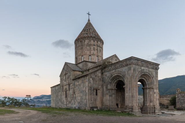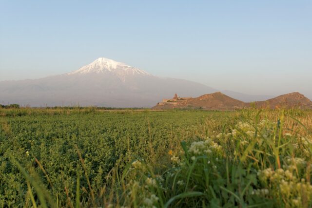
Armenia’s best hikes run the full range, from an easy monastery-to-monastery forest walk in Dilijan to the high, breathless climb up Mount Aragats and the long-distance Transcaucasian Trail. If you only want the shortlist: the Transcaucasian Trail’s Parz Lake to Goshavank leg is the best easy-to-moderate day hike, Aragats’ south summit is the marquee mountain, and the Garni gorge walk to the Symphony of Stones is the quickest reward near Yerevan. Below they are sorted by region and difficulty, with honest times, seasons, and safety notes.
This is the curated, route-by-route roundup. For the wider picture on gear, seasons, guiding, and trail conditions, start with our complete guide to hiking in Armenia, and for the country’s highest walk-up peak see the dedicated Mount Aragats climb guide.
Which Armenian hikes are worth your time?
These are the trails that repeatedly earn their place: notable scenery, a clear route, and a reason to go beyond just logging distance. The table gives you the quick comparison; the sections below add the detail and the caveats.
| Hike | Region | Difficulty | Rough time |
|---|---|---|---|
| Garni gorge to Symphony of Stones | Kotayk (near Yerevan) | Easy | 1–2 hr |
| Parz Lake to Goshavank (TCT) | Dilijan, Tavush | Easy–moderate | ~2.5–3.5 hr |
| Haghartsin forest trails | Dilijan, Tavush | Easy | 1–3 hr |
| Khndzoresk swinging bridge & cave village | Syunik (near Goris) | Easy–moderate | 1–2 hr |
| Smbataberd fortress | Vayots Dzor | Moderate | Half day |
| Mount Aragats, south summit | Aragatsotn | Strenuous (altitude) | Full day |
| Khustup peak | Syunik (near Kapan) | Very strenuous | Long full day |
What is the best easy hike in Armenia?
For a first walk with almost no risk and a genuine payoff, do the Garni gorge walk down to the Symphony of Stones, about 40 km east of Yerevan. From Garni village you drop into the gorge to reach a wall of hexagonal basalt columns formed by cooling lava, a free natural formation and a short, mostly flat there-and-back that most people finish in one to two hours. It pairs perfectly with a visit to the 1st-century Garni Temple and Geghard Monastery in the same day. Full route notes are in our Symphony of Stones guide.
The other standout easy region is Dilijan, in the forested Tavush highlands often called “Armenian Switzerland.” The short loops and out-and-back trails around Haghartsin Monastery and through Dilijan National Park are gentle, shaded, and good in summer heat. Our Dilijan travel guide covers where the trailheads start and how to get there.
The Transcaucasian Trail: Parz Lake to Goshavank
The single best moderate day hike for most visitors is the Dilijan section of the Transcaucasian Trail (TCT), the long-distance route being built across the South Caucasus. The signposted leg from Parz Lake, a small forest lake in Dilijan National Park, to the medieval Goshavank Monastery runs roughly 7 km through beech and hornbeam woodland. It is well marked, undulating rather than steep, and takes most walkers around two and a half to three and a half hours one way at an easy pace. Because it is point to point, arrange a taxi or tour pickup at Goshavank, or turn back to Parz Lake if you want a there-and-back. Check the current trail status and downloadable maps on the official Transcaucasian Trail site before you set out.
What is the best mountain hike in Armenia?
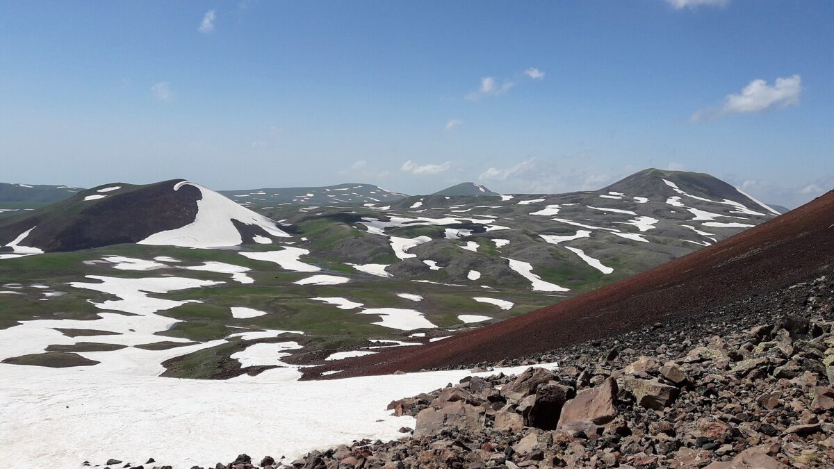
Mount Aragats is the country’s high-altitude prize and its most famous summit hike. The extinct volcano has four peaks around a central crater, and the south summit is the lowest of the four and the only one most hikers should attempt without mountaineering skills. The standard route starts high, near Lake Kari, which shortens the climb but does not make it casual: this is a strenuous walk at real altitude, with loose rock near the top, and it should be treated as a serious mountain day, not a stroll.
Season matters enormously here. Snow lingers on the upper slopes into summer, so the realistic window for the south summit is roughly July to September. Go early, watch the weather, and turn back if cloud closes in, common on August afternoons. Altitude is the main hazard: ascend at a steady pace, carry water and warm layers even on a hot day in Yerevan, and do not push on if you get a headache or nausea. The other three peaks (north, west, east) involve exposure and scrambling and are not day-hike territory for casual visitors. We break the routes, timings, and Lake Kari logistics down in the full Mount Aragats climb guide.
Which hikes combine history with a good walk?
Some of Armenia’s most satisfying trails end at a monument rather than a viewpoint.
Smbataberd fortress, Vayots Dzor
Smbataberd is a restored medieval fortress strung along a high ridge in Vayots Dzor, in the south. The walk up from the valley (many hikers start from near Yeghegis) is a moderate half-day effort with a steady climb, rewarded by long views over the surrounding ranges and the dramatic sight of the walls following the spine of the ridge. Many people continue on to Tsakhats Kar Monastery to make a fuller loop. The region and its trailheads are covered in our Yeghegnadzor and Vayots Dzor guide. Late spring through autumn is the comfortable window; the exposed ridge is hot at midday in summer.
Khndzoresk swinging bridge and cave village, Syunik
Near Goris in the south, Old Khndzoresk is an abandoned cave settlement carved into a canyon of soft rock. A modern suspension “swinging bridge” spans the gorge, and the paths that wind down among the old cave dwellings make for an easy-to-moderate hour or two of walking with plenty of up and down. It is one of the most distinctive short walks in the country and pairs naturally with the Tatev cable car region. See our Goris and Khndzoresk guide for access and timing.
What about the hardest hikes, and are they safe?
Armenia has genuinely tough peaks for experienced hikers. Khustup, the striking mountain above Kapan in the far south (Syunik), is a long, very strenuous full-day climb that rewards fit walkers with some of the finest ridge views in the country. Treat it as a serious ascent: early start, proper footwear, plenty of water, and ideally a local guide, as the upper route is demanding and remote.
There is one non-negotiable safety layer in the south and southeast. The Armenia–Azerbaijan border is militarized and closed, and travel advisories flag specific frontier zones. As of early 2026, the UK FCDO advised against all travel within 5 km of the eastern Armenia–Azerbaijan border, and the US State Department urged travelers to avoid parts of eastern Gegharkunik, Syunik east of Goris, and Syunik south of Kapan. That directly affects planning around far-southeastern peaks. Before committing to any hike in Syunik or the east, check the current advisories the week you travel (they change as the peace process moves), confirm your specific trailhead is well clear of restricted zones, and hire a local guide who knows exactly which valleys are off-limits. Note also that Nagorno-Karabakh has been under Azerbaijani control since 2023 and is not accessible from Armenia; do not plan hikes there.
For everywhere else, the classic tourist regions, Dilijan, Kotayk, Aragatsotn, and the Vayots Dzor valleys, are well outside the sensitive zones and are considered safe, with low street crime nationally. The ordinary mountain hazards apply: weather, altitude on Aragats, sun exposure, and sparse water on exposed ridges.
When is the best season to hike in Armenia?
The prime hiking window is late April to June and September to October, the shoulder seasons, with September widely regarded as the single best month: dry, clear, and cooler, with autumn colour in the forests. Spring brings green slopes and wildflowers but can leave snow high on Aragats. Summer (roughly 16–28°C in the mountains) is peak season for high routes, but August is the hottest month with afternoon thunderstorms, so start early and be off exposed ridges and summits by early afternoon. Winter closes the high peaks to all but equipped mountaineers, though low forest walks and the ski slopes at Tsaghkadzor stay open.
How do you get to the trailheads?
Most trailheads are easiest to reach by car, taxi, or organized day tour, since public minibuses (marshrutkas) drop you in towns rather than at trailheads. Dilijan and Lake Sevan are reachable by marshrutka from Yerevan’s Gai (Northern) bus station; Garni sits about 40 km east and is a short taxi or bus ride, and the Symphony of Stones walk starts from the village. For Aragats’ Lake Kari start, the fortresses of Vayots Dzor, and the southern peaks around Goris and Kapan, a rented car (roughly 25–40 USD a day for an economy model) or a booked tour is by far the simplest option, and it lets you reach trailheads early. Practical transport detail sits in our hiking in Armenia guide.
Last verified: September 2026. Prices and border advisories change; reconfirm the volatile items the week you travel.
Sources
- Transcaucasian Trail — official trail routes, maps, and status
- armenia.travel — Armenia’s official tourism portal
- UK FCDO travel advice for Armenia
- US State Department travel advisories
Frequently asked questions
Do you need a guide to hike in Armenia?
For easy, well-marked routes like the Garni gorge walk, the Dilijan forest trails, or the Transcaucasian Trail’s Parz Lake to Goshavank leg, you can hike independently. For Mount Aragats, Khustup, and any route in southern Syunik near the border, a local guide is strongly recommended for safety, navigation, and knowing which valleys are off-limits.
What is the best time of year to hike in Armenia?
Late April to June and September to October are the prime windows, with September often the best month: dry, clear, and cooler with autumn colour. High peaks like Aragats are only realistically hikeable from about July to September once snow clears. August is hottest with afternoon storms, so start early.
Is the Mount Aragats south summit hike hard?
It is strenuous. The south summit is the lowest of Aragats’ four peaks and the only one suitable for hikers without mountaineering skills, but it is a serious high-altitude day with loose rock near the top. Start early, carry warm layers and water, watch the weather, and descend if you feel altitude sickness.
Are hikes in southern Armenia safe near the Azerbaijan border?
The classic hiking regions are safe, but the Armenia-Azerbaijan border is militarized and closed. As of early 2026, advisories warned against travel within 5 km of the eastern border and in parts of Syunik east of Goris and south of Kapan. Check current UK FCDO and US State Department advice the week you travel and confirm your trailhead is well clear of restricted zones.
Which is the easiest good hike near Yerevan?
The walk through Garni gorge to the Symphony of Stones, about 40 km east of Yerevan, is the easiest high-reward option: a short, mostly flat there-and-back to a wall of hexagonal basalt columns, finishable in one to two hours and easily combined with Garni Temple and Geghard Monastery.
Featured image: Լիլիթ85, CC BY-SA 4.0 — via Wikimedia Commons.