Mount Aragats is a massive four-peaked extinct volcano in Aragatsotn province, northwest of Yerevan, and its northern summit is the highest point in Armenia at roughly 4,090 metres. Its four summits ring a central crater, and one of them, the South peak at about 3,890 metres, is a walk-up that fit hikers reach without ropes or technical skill. That single fact is what makes Aragats unusual: Armenia’s tallest mountain has a top you can stand on after a few hours of steady uphill walking, provided you respect the altitude and the weather.
This guide covers the four peaks and which one to climb, the Lake Kari trailhead and the standard route up the South summit, when to go, the real risks, how to get there, and how to fold in Amberd fortress and the Byurakan observatory on the way down.
What is Mount Aragats?
Aragats is an isolated extinct stratovolcano whose eruptions built a broad cone with a collapsed central crater. Four distinct summits sit around the rim of that crater, each named for its compass direction:
- North peak — approximately 4,090 m, the highest of the four and the highest point in Armenia. The hardest of the summits and a genuinely serious mountain day.
- South peak — approximately 3,890 m. The lowest of the four and by far the most-climbed, because it is a non-technical hike.
- West peak — the second highest after North, and a demanding objective in its own right.
- East peak — the most accessible after South, often combined with it by stronger hikers.
The mountain dominates the skyline northwest of Yerevan and is close enough to the capital that the South peak can be done as a long day trip. Because the four summits sit around a crater, reaching all four in one push means a committing traverse over rock and lingering snowfields, which is a different undertaking altogether from the popular South-peak walk.
Which peak should you climb?
For almost everyone, the answer is the South peak. It is the shortest, lowest and least technical of the four, and it starts from the highest road-accessible trailhead in the country, so you begin the climb already most of the way up. If you are an experienced mountain hiker with a head for altitude and settled weather, the North peak is the trophy, but treat it as a proper ascent rather than a stroll. The West and North summits should not be attempted casually, and the full four-summit crater traverse is for confident mountaineers only.
The Lake Kari trailhead and the South peak route
The climb starts at Lake Kari (Kari Lich), a small glacial lake at roughly 3,200 metres on the mountain’s flank. A paved mountain road runs all the way up to it, and there is a cosmic-ray research station and weather station beside the lake, so you can drive or be dropped almost to the base of the walk. Starting at 3,200 m means the South peak, at about 3,890 m, involves only a few hundred metres of ascent rather than the full height of the mountain.
From the lake, a worn path climbs across alpine meadow and volcanic scree toward the South summit. It is a steady uphill slog rather than a scramble: no ropes, no exposure that requires climbing skill, just a rising trail over rock and, early in the season, patches of snow. Most reasonably fit walkers reach the South peak in roughly two to four hours from the lake, with a shorter descent, though your pace at altitude will be slower than you expect at sea level. Give yourself the whole day and start early.
What you actually need is less about technique and more about preparation. There is no ticket office or set fee for the hike itself; the cost is your transport up to Lake Kari. Pack for a real mountain even on a warm morning:
- Footwear: sturdy boots or trail shoes with grip for loose scree and, early in the season, snow.
- Layers: a warm mid-layer and a windproof or waterproof shell, because it can be cold and blustery on top in the middle of summer.
- Sun protection: hat, sunglasses and sunscreen — the sun is fierce at altitude, and snowfields reflect it back at you.
- Water and food: more water than you think, plus snacks; there is nothing to buy above the lake.
- A turn-around time: decide before you start when you will head down regardless of how close the summit looks.
Poles help on the scree descent, and a basic map or offline route on your phone is worth having if cloud rolls in.
When is the best season to climb Aragats?
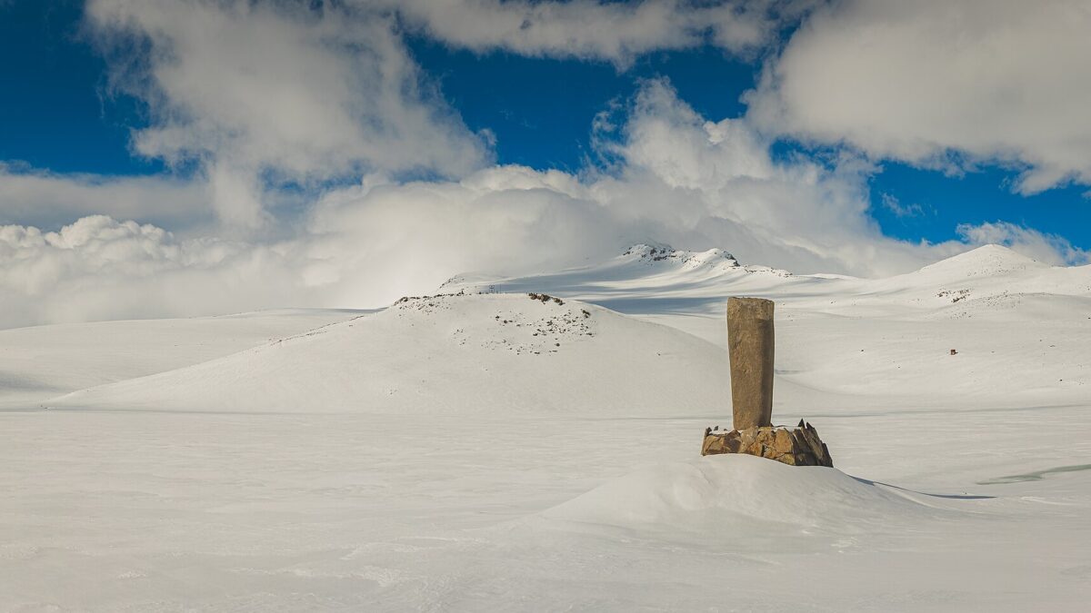
The realistic climbing window is roughly July to September, with the shoulder of that range being the safest bet. Snow lingers on the upper slopes well into summer, and the crater and higher peaks hold it even longer, so early-season attempts often mean crossing snowfields. September tends to be dry and stable and is widely considered Armenia’s finest month for the outdoors, which makes it a strong choice for the South peak.
Outside that window the mountain becomes a snow objective that is out of scope for casual hikers. Even within summer, afternoons can turn: cloud, wind and storms build over high ground, and August in particular brings afternoon thunderstorms across Armenia. The pattern argues for an early start and an early finish.
Altitude and weather: the real challenges
The South peak is not technically difficult, so the two things that actually catch people out are altitude and weather. Starting at 3,200 m and topping out near 3,890 m puts you high enough that thin air matters: expect to move slowly, and do not ignore headaches, nausea or dizziness. If you have come straight from low elevation, a night or two in Armenia’s higher country beforehand helps. The weather can flip from sunshine to cold, wind-driven cloud within an hour, which is exactly why a turn-around time and warm layers are non-negotiable even on a bright morning. None of this is meant to scare you off a very achievable hike; it is meant to keep an easy walk from becoming a bad day.
How to get to Aragats and Lake Kari
Aragats sits northwest of Yerevan in Aragatsotn, close enough for a day trip but not well served by public transport for the climb itself. There is no convenient scheduled bus to Lake Kari, so the practical options are a hired car or taxi for the day, a rental car if you are comfortable on mountain roads, or an organised hiking tour from Yerevan. The road up to the lake is paved but climbs steeply through changing weather, so allow time and check conditions. Driving yourself gives you the flexibility to start at dawn, which is the single best thing you can do for both weather and altitude. For the wider context on trails and trailheads around the country, see our guide to hiking in Armenia.
Combining Aragats with Amberd and Byurakan
The southern slopes of Aragats hold two of the region’s best stops, both roughly on the way between Yerevan and Lake Kari, which makes them natural add-ons to a mountain day, especially if the summit weather closes in.
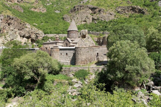
Amberd fortress stands on a promontory above the confluence of two gorges on Aragats’s southern flank, a medieval castle-and-church complex with one of the most dramatic settings in the country. It is a rewarding visit in its own right and an obvious pairing with the mountain. We cover the site in detail in our Amberd fortress guide.
Byurakan Observatory, also on the southern slopes, is one of the most important astronomical observatories in the region and a piece of living scientific heritage. Its position on Aragats, away from city light and high above the plain, is exactly why it was built here. Between the fortress, the observatory and the summit walk, the southern side of Aragats easily fills a full and varied day out from Yerevan.
Is climbing Aragats worth it?
For a hiker who wants to stand on the roof of a country without needing mountaineering skills, the South peak of Aragats is one of the best value days in the Caucasus: a drive to 3,200 m, a few hours of honest uphill walking, and a 3,890 m summit with views over the crater and the volcanic tableland below. The catch is that it rewards good timing and honest self-assessment, not bravado. Pick a settled day in the July-to-September window, start early, carry layers, and turn around if the weather sours. The North peak and the crater traverse remain for another, better-prepared trip.
Prices and access for transport and any organised tours can change, so confirm current details with an official source and your driver or operator before you commit.
Last verified: September 2026.
Sources
- Armenia Travel (armenia.travel) — official national tourism portal
Frequently asked questions
How high is Mount Aragats?
Mount Aragats has four summits around a central crater. The North peak, at roughly 4,090 metres, is the highest and is the highest point in Armenia. The South peak is about 3,890 metres, the East and West peaks fall in between, with West being the second highest.
Do you need climbing experience to summit Aragats?
Not for the South peak, which is the most-climbed of the four. It is a non-technical uphill walk from Lake Kari, with no ropes required. The North and West peaks and the full four-summit crater traverse are serious undertakings that do call for real mountain experience.
Where does the Aragats climb start?
The standard route to the South peak starts at Lake Kari, a small lake at roughly 3,200 metres reached by a paved road, next to a research and weather station. Because you begin so high, the South summit involves only a few hundred metres of ascent.
What is the best time to climb Mount Aragats?
Roughly July to September, with September often the most stable. Snow lingers on the upper slopes and around the crater into summer, and afternoon storms are common, so an early start on a settled day is best. Outside this window it becomes a winter snow climb.
How long does it take to climb the South peak?
Most reasonably fit hikers reach the South peak in roughly two to four hours from Lake Kari, with a shorter descent. Plan for the whole day, start early, and move slowly to account for the altitude above 3,200 metres.
Can you visit Amberd and Byurakan on the same trip?
Yes. Amberd fortress and the Byurakan Observatory both sit on the southern slopes of Aragats, roughly on the route up from Yerevan, so they pair naturally with the climb or make a good alternative if summit weather closes in.
Featured image: mk4oto https://www.instagram.com/mk4oto/, CC BY-SA 4.0 — via Wikimedia Commons.