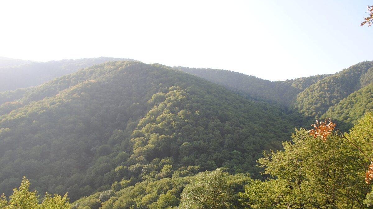
Shikahogh State Reserve is a 12,371-hectare block of old oak and beech forest on the northern slopes of the Meghri ridge in Syunik, about 23 km by road from Kapan and a few kilometres from the Iranian border. It is Armenia’s second-largest strict reserve after Khosrov, it sits inside the leopard corridor that links Iran to the Caucasus, and almost nobody goes. There is no visitor centre, no ticket booth and no trailhead you can simply drive up to; you enter with a permit from the Zangezur Biosphere Complex and, realistically, a local guide. The one piece everybody reaches without paperwork is the Plane Grove sanctuary on the Tsav river near Nerkin Hand, and that alone justifies the detour south of Kapan.
What Shikahogh is
The reserve was created on 13 September 1958 out of the Kapan forestry unit, according to the Ministry of Environment’s register of state reserves. NABU Armenia adds a twist most summaries skip: it was downgraded to the “Bartas” reserve in 1963 and only restored in 1975. Older sources still give 10,330 ha; the ministry’s current register says 12,371.1 ha.
Shikahogh occupies the basins of the Tsav and Shikahogh rivers in two precincts, Shikahogh and Mtnadzor, and NABU puts forest cover at about 94 per cent. The high ground is a line of Meghri-ridge peaks: Shakhbuz (2,372 m), Gyumarants (2,366 m), Mazra (2,198 m) and Bartas (2,186 m); the low end is around 700 m where the Tsav valley opens, so the reserve spans roughly 1,700 vertical metres of unbroken woodland.
Since 19 December 2013 Shikahogh has been one of seven protected areas run by the “Zangezur” Biosphere Complex, a state non-commercial organisation (SNCO) under the Ministry of Environment, alongside Arevik National Park, the Zangezur sanctuary (25,711.6 ha), the Khustup sanctuary (6,946.74 ha), Sev Lich, Boghakar and the 64.2-ha Plane Grove; about 79,400 ha in all, per the Caucasus Nature Fund (CNF). Since 2016 Shikahogh, Plane Grove and Khustup form the SNCO’s “Shikahogh branch” (Ecolur). CNF co-finances running costs: 90,000 euros in April 2026, matched by the state budget.
The honest caveat: this is a strict reserve (արգելոց), the most restrictive category in Armenian law, not a national park. Recreation is tolerated, not designed for.
The 2005 road fight
Shikahogh is best known in Armenia for a road that was never built through it. In late 2004 the government approved a 96-km Kapan–Meghri highway to give Iranian trucks a lower route than the 2,563-m Meghri pass; the draft alignment put 17 km of it inside the reserve. The “SOS Shikahogh” coalition of more than 40 NGOs (WWF, Armenia Tree Project, the AUA Acopian Center) campaigned from May 2005, and on 27 June 2005 RFE/RL reported that President Kocharian had approved a bypass adding 7 km and 9.3 billion drams. The road opened in October 2007 (80 km, 1,980-m high point, Iranian assistance). It is still the clearest case in independent Armenia of a protected area beating a strategic infrastructure project.
The forest and wildlife: what you will actually see
The ministry lists the protected objects as oak-beech forest and relict yew and plane groves surviving from the Tertiary period. On the ground that means oak on the drier south-facing slopes, oriental beech and hornbeam in the shadier gullies, and wild pear, apple and walnut through the canopy. The European yew (Taxus baccata) grove is itself in Armenia’s Red Book. NABU counts about 1,100 plant species, 70 of them Red-Book-listed; the Armenian Travel Bureau’s botanical summary names endemics such as Pyrus zangezura, Symphyandra zangezura and Tulipa confusa.
The ministry’s fauna list reads like a wish list: Caucasian leopard, brown bear, bezoar goat, Caspian snowcock, Caucasian black grouse, boreal owl, pheasant and Armenian viper. Lynx, wild boar, roe deer and wolf are reported by other sources.
What you will realistically see on a day walk: bear scat and claw marks, boar rooting, roe deer at dawn, plenty of birds, and possibly bezoar goats on the crags above the treeline if your guide knows where to glass. You will not see a leopard. Armenia’s whole population is under 15 animals (World Land Trust) and the complex’s camera traps are the only reliable witnesses: WWF Armenia recorded a young female, “Misty”, in spring and November 2024, and in December 2024 the environment minister released footage of a leopard with a cub somewhere in the complex, without saying which of the seven areas. Shikahogh’s value to leopards is as a forested bridge between Iran and Khosrov to the north; yours as a visitor is leaving it undisturbed.
Three lakes, Tsakhkar, Kaputan and Gazan, are registered natural monuments inside the reserve; Kaputan, on the high ridge, is the one guides propose for a long day.
The Plane Grove sanctuary
“Sosu Park” (Սոսու պուրակ) is a separate 64.2-ha sanctuary founded on the same day as the reserve, 13 September 1958, in the Tsav river floodplain at 700–800 m beside Nerkin Hand village, according to the ministry’s sanctuary register. It protects the largest natural stand of oriental plane (Platanus orientalis) in the Caucasus, mixed with walnut; Hetq describes the core as several trees over a thousand years old. The grove is flat, shaded, walkable in an hour and sits beside the Tsav–Nerkin Hand road, which is why it is the one part of the complex casual visitors reach. The June 2026 ministry notice says new trail signs went in here too and that trails inside protected areas need an advance permit. In practice the grove has been visited freely for years; ask at the village or the Kapan office rather than assume.
Villages and local guides
Five villages ring the reserve: Shikahogh, Srashen, Tsav, Shishkert and Nerkin Hand. Shikahogh village had 160 residents in 56 households when JAMnews interviewed its head, Nare Ghazaryan, in March 2021; about 2,000 tourists a year came before the 2020 war and several families ran guesthouses. Tsav is 5 km south of Shikahogh; Nerkin Hand is 6 km east of Tsav, at the end of the road.
The local operator to know is “Guides from the South”, a Kapan-based NGO led by Robert Matevosyan that trained 27 village guides and built a 70-km Kapan–Meghri walking route through eight communities, Shikahogh among them. JAMnews reported that Aramayis Tadevosyan runs a two-storey guesthouse in Shikahogh and his son Bagrat drives 4×4 excursions. Expect to arrange these by phone through Kapan contacts or the village office, not online. Guides are not legally mandatory, but there is no waymarked network beyond the newly signed sections and GPS under beech canopy is poor.
How to visit: rules, permits, fees
- Permit: required. The Ministry of Environment’s 3 June 2026 notice on the Zangezur complex states that an entry permit must be obtained in advance for any trail inside the specially protected areas, Shikahogh included. The notice does not say how; the Zangezur Biosphere Complex office in Kapan is the place to ask, and a guide will normally arrange it for you.
- Fee: unverified. The ministry revised protected-area fees from April 2026 but published no figure for Shikahogh that we could find. Budget a few thousand drams and confirm.
- Guide: strongly advised, and probably a condition of the permit beyond the Plane Grove.
- Camping, fires, drones, off-trail hiking: assume all are prohibited in a strict reserve unless the SNCO says otherwise in writing.
- Opening: no gates or hours; the limits are snow above 1,800 m from roughly November to May and the 2026 trail works, which the ministry said would continue through the season.
Getting there
Kapan is the base: roughly 320 km and six to seven hours from Yerevan via Goris; read the driving and car-rental guide first. One critical detail: since 2021 a 21-km stretch of the M2 between Goris and Kapan has run through Azerbaijani-controlled territory with a checkpoint, and Armenian traffic uses the rebuilt Kapan–Aghvani–Tatev–Halidzor bypass, paved and about as fast. Your navigation app may not know this; follow signs.
From Kapan the Shikahogh road is 23 km. The first 7.5 km, the Kapan–Chakaten bypass, was asphalted in 2022 (Armenpress) and the road continues through Chakaten, Shikahogh, Srashen and Tsav to Shishkert; allow 45 minutes. Marshrutkas reach the villages from Kapan on a thin schedule; check the day before. From Meghri, the 2007 highway that bypassed the reserve crosses the Meghri ridge, with the Tsav turn-off on the Kapan side. Cyclists use the quiet asphalt over the Baghdad pass as an alternative to the M2; one Komoot track logs 42.5 km and 930 m of climbing.
When to go
| Season | What to expect |
|---|---|
| April–May | Snowdrops, tulips and flowering fruit trees at 700–1,200 m; rivers high; upper lakes still under snow. |
| June–September | Full access to the ridge and Kaputan lake; hot in the low Tsav valley by day. Best overall. |
| October | Beech and oak colour, bear activity, walnut harvest. Best month for the Plane Grove. |
| November–March | Low valley walkable, ridge closed, village guesthouses may be shut. |
Where to stay
Few and informal. Shikahogh village has at least one family guesthouse (the Tadevosyan house) and others that operated before 2020; Tsav has a handful of rooms on Airbnb; Nerkin Hand is a frontline village, not a place to look for a bed. Most visitors sleep in Kapan, which has proper hotels, and treat the reserve as a day trip; see the Kapan guide.
Practical and safety notes
Read the geography straight. The Meghri ridge south of the reserve is the Iranian border, and since the 2020 war and the September 2022 clashes the Azerbaijani line of control sits within 100 m of Nerkin Hand’s houses; gunfire damaged a house there in February 2024 and again in June 2025 (OC Media, RFE/RL), with no casualties. Shikahogh village says it now shares about 30 km of de-facto border with Azerbaijan. Nobody was evacuated and daily life continues, but: carry your passport, do not photograph military posts, do not wander east of Nerkin Hand, and let your guide set the limits. The safety guide covers Syunik generally. Mobile signal is patchy in the valley and absent in the forest. Bears are common; make noise and seal your food. The Armenian viper is real; wear boots.
Pair it with
Khustup (3,201 m), the peak above Kapan, is the obvious two-day combination; its sanctuary is run by the same SNCO. Tatev monastery is 60 km north on the bypass road; see the Tatev guide. Meghri is an hour and a half over the ridge for pomegranates, the fortress and the Iranian crossing at Agarak. The southern road-trip itinerary strings these together.
Worth it?
For the Plane Grove: yes, unconditionally, if you are already in Kapan. For the reserve proper: yes, if you accept a guided forest walk rather than a safari, and a morning spent on permits and phone calls. Skip it if you want signage and a cafe at the end; Dilijan does that. Shikahogh’s point is precisely that it never got the road.
Last verified: October 2026. Permit procedure, fees and village guesthouse availability change; confirm with the Zangezur Biosphere Complex office in Kapan before travelling.
Frequently asked questions
Do I need a permit to visit Shikahogh State Reserve?
Yes. The Armenian Ministry of Environment’s June 2026 notice on the Zangezur Biosphere Complex states that an entry permit must be obtained in advance for trails inside its protected areas, Shikahogh included. The procedure is not published online; ask the Zangezur Biosphere Complex office in Kapan or have a local guide arrange it.
Can I see a Caucasian leopard in Shikahogh?
Realistically, no. Armenia has fewer than 15 leopards and sightings come from camera traps run by WWF Armenia and the reserve staff, most recently a female and a cub filmed in the Zangezur complex in late 2024. Expect bear sign, boar, roe deer and perhaps bezoar goats on the high crags instead.
How far is Shikahogh from Kapan and what is the road like?
About 23 km, roughly 45 minutes. The first 7.5 km (the Kapan-Chakaten bypass) was asphalted in 2022 and the road continues through Shikahogh, Srashen and Tsav to Shishkert; the Plane Grove sanctuary near Nerkin Hand is a further 6 km east of Tsav.
Is Shikahogh safe given the Iranian and Azerbaijani borders?
The reserve itself and the villages of Shikahogh, Srashen and Tsav see normal daily life, but Nerkin Hand lies within 100 m of Azerbaijani positions and has had gunfire incidents in 2024 and 2025. Stay with a local guide, carry ID, avoid military posts and do not go east of Nerkin Hand.
Featured image: Otocolobus manul, CC BY-SA 4.0 — via Wikimedia Commons.