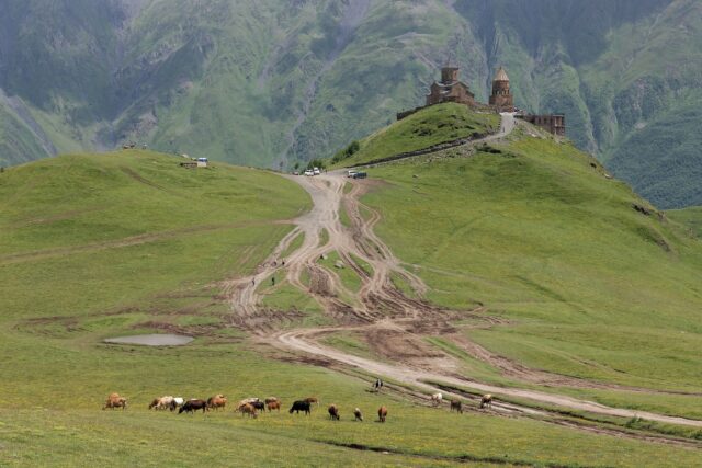
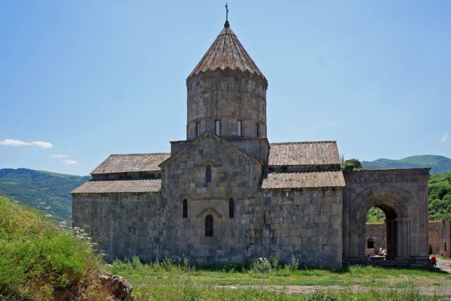
The southern Armenia road trip runs Yerevan → Khor Virap → Areni and Noravank (Vayots Dzor) → the Selim caravanserai → Jermuk → Goris and Old Khndzoresk (Syunik) → the Wings of Tatev cable car, with the far south toward Meghri and the Iran border as an optional extension. Give it three to four days minimum, and drive it rather than relying on buses.
This is a different trip from our shorter Yerevan-based loops. It points one direction — south — and treats the M2 highway and the mountain roads of Vayots Dzor and Syunik as the whole point. Below is a stop-by-stop route with driving notes, the honest case for hiring a car, the road and fuel realities nobody warns you about, and a border-safety caveat you should read before you plan the far south.
What is the best road trip in southern Armenia?
The strongest south route is Yerevan down the M2 to Khor Virap, into Vayots Dzor for Areni wine and Noravank gorge, over to Jermuk, then further south to Goris for Old Khndzoresk and the Wings of Tatev cable car. That single line covers Armenia’s best canyon monastery, its wine heartland, a spa town and its most famous cable car in one continuous drive.
Most travellers turn around at Tatev and head back north. Continuing past Kapan to Meghri on the Iran border adds serious driving and a border-zone caution (see below), so treat it as an add-on for people who genuinely want the far south, not a default leg.
The route at a glance
Distances are approximate; mountain roads make time, not kilometres, the real measure. The full run from Yerevan to Tatev is roughly 250 km and over four hours of pure driving before you stop anywhere.
| Stop | What it is | Driving note |
|---|---|---|
| Khor Virap | Monastery with the classic Mount Ararat view; free entry | ~40 km / ~50 min south of Yerevan on the M2; short paved spur off the highway |
| Areni | Wine village; Areni-1 cave, the world’s oldest known winery | ~1.5 hr further into Vayots Dzor; easy paved highway |
| Noravank | 13th-century red-cliff gorge monastery; free | ~8 km up a narrow canyon side-road from Areni — slow, dramatic, paved |
| Selim (Orbelian) caravanserai | 14th-century Silk Road inn on the Vardenyats Pass; free | Optional high-pass detour toward Lake Sevan; can be snow-blocked outside summer |
| Jermuk | Spa town, waterfall, mineral water | ~1 hr detour up a valley off the main southbound road |
| Goris | Stone town, gateway to Syunik; base for Tatev | ~2.5–3 hr from Vayots Dzor over mountain passes; paved but winding |
| Old Khndzoresk | Abandoned cave village with a swinging footbridge | ~10 km east of Goris; short drive then a steep walk down |
| Wings of Tatev | 5.7 km cable car to Tatev Monastery | Board at Halidzor, ~30–40 min from Goris |
| Meghri (optional) | Southernmost town, on the Iran border | ~2.5–3 hr south of Goris via Kapan; check advisories first |
Do you need a car for southern Armenia?
Effectively, yes. Public transport reaches the south but does it badly: roughly two marshrutkas a day run Yerevan to Goris (around 2,500–3,500 AMD, four to six hours), there is no direct minibus to the Tatev cable car, and side-trips to Noravank, Jermuk and Khndzoresk mean waiting on infrequent or non-existent connections. A car turns a fragmented three-day slog into a flexible loop.
Rental in Yerevan runs roughly $25–40/day for an economy car, $35–50 for a sedan and $50–80 for an SUV, plus collision damage waiver at about $8–15/day (last verified: July 2026). If you would rather not drive the passes yourself, hiring a car with a driver, or booking a Goris-based day tour to Tatev, is a legitimate alternative — we cover the trade-offs in our guide on how to get around Armenia. For the far south specifically, a car is close to mandatory.
Yerevan to Vayots Dzor: the first day south
Leave Yerevan early and make Khor Virap your first stop. Entry is free, and the draw is the view of Mount Ararat rising behind the monastery walls — clearest early in the morning and in the October-to-April window, since summer haze often swallows the peak. Ararat sits about 20 km away across the closed Turkish border, so this is as near as you get.
From there the M2 carries you into Vayots Dzor and Areni, the indigenous wine village. The Areni-1 cave here holds the world’s oldest known winery, around 6,100 years old, alongside a 5,500-year-old leather shoe. Several cellars pour tastings for a few thousand AMD; if you time the trip for early October, the Areni Wine Festival lands then. We go deeper on the grape and the cellars in our Armenian wine guide.
Eight kilometres up a side canyon from Areni, Noravank closes out the day. The 13th-century monastery sits against sheer red cliffs, and its two-storey church with the narrow external stone stair is the image most people carry away from southern Armenia. Entry is free. The access road is paved but tight, with the gorge walls glowing at their reddest in late-afternoon light — a reason to arrive after the tour buses thin out rather than at midday. Take the last few bends slowly.
Jermuk, Selim and the mountain middle
Two worthwhile detours sit in the middle of the route. Jermuk, about an hour up its own valley, is a Soviet-era spa town known for mineral springs and a tall waterfall — a calm overnight if you want to break the driving, and the subject of our Jermuk spa town guide. The Selim, or Orbelian, caravanserai is a 14th-century Silk Road inn on the Vardenyats Pass, a stone hall that has sheltered travellers for seven centuries. Both are free.
One honest caveat: the Selim Pass is high, and it can be blocked by snow outside the warm months. If you are driving in spring or autumn, confirm the pass is open before committing to it, or you will backtrack.
Goris, Old Khndzoresk and Tatev
Goris is the hub of the deep south — a low town of stone houses that makes the natural base for everything in Syunik. From here it is a short drive east to Old Khndzoresk, an abandoned cliff-village of cave dwellings reached by a swinging footbridge strung across the gorge. Our Goris and Old Khndzoresk guide covers the walk down and back, which is steeper than it looks.
The headline sight is the Wings of Tatev, the world’s longest reversible aerial tramway at 5.7 km, running about 11–12 minutes each way from Halidzor across the Vorotan gorge to Tatev Monastery. Round-trip tickets run roughly 6,500–9,000 AMD (about $18–25) for an adult (last verified: July 2026); prices have moved, so confirm on the official tatever.am ticket page. It usually closes Mondays outside peak summer. The Tatev area itself is a normal, popular destination — full detail is in our Wings of Tatev cable car guide.
Is southern Armenia safe to drive?
The core route — Yerevan, Vayots Dzor, Goris, Khndzoresk and Tatev — is safe and sits well away from any restricted zone. The one real sensitivity is the militarised Armenia–Azerbaijan border in the far southeast. Goris and Tatev are fine; the caution applies to the southern highway beyond, toward Kapan and Meghri.
Read the advisories yourself before the far south. The UK FCDO (updated 1 March 2026) advises against all travel within 5 km of the eastern Armenia–Azerbaijan border. The US State Department (Level 2, updated 5 September 2025) flags Syunik east of Goris and south of Kapan and says the immediate border is Do Not Travel. The situation is tied to an ongoing and volatile peace process, so recheck the week you go — we keep the fuller picture current in is Armenia safe for tourists. Nagorno-Karabakh, sometimes muddled into this region, has been under Azerbaijani control since 2023 and is not accessible from Armenia.
Road and fuel realities in the south
Main routes are paved and generally fair, but the qualifiers matter once you leave the M2. Expect potholes and unpaved stretches on side-roads, tight switchbacks over the passes, and livestock on the carriageway in rural stretches — a real hazard at dusk. Fuel stations thin out badly in the remote south, so fill up in Goris before pushing toward Meghri rather than assuming a pump will appear. Winter adds snow and closed high passes to the list.
Practical calls we would make: take the SUV tier if you plan any off-highway detours or shoulder-season driving; carry cash, since the countryside is largely cash-based and card acceptance is a Yerevan luxury; and do not schedule the passes for after dark. An eSIM or a Viva-MTS tourist SIM (roughly 2,500 AMD for 15 days, last verified: July 2026) keeps navigation live where signage is thin. Build slack into each day, too — the map’s estimated times assume you never stop for a monastery, a viewpoint or a slow tractor, and on these roads you will do all three.
How long do you need for a southern Armenia road trip?
Three days is the honest minimum for Yerevan to Tatev and back — one day south through Vayots Dzor, one for Goris, Khndzoresk and the cable car, one to return. Four days lets you overnight in Jermuk or add the Selim Pass without rushing the drives. Adding Meghri and the far south realistically needs five to six, given the distances and the border checks. Trying to do the whole thing as a day trip from Yerevan does not work; the cable car alone is 250 km and four-plus hours each way.
If you want this route slotted into a longer trip, our 10-day Armenia itinerary folds the south into a full-country loop, and the itineraries category collects our other route plans.
Featured image: Diego Delso (CC BY-SA 4.0) via Wikimedia Commons
Sources: For up-to-date official guidance, see the UK Foreign Office’s Armenia travel advice and Armenia’s official tourism board. Last verified: July 2026.