Armenia packs an unusual amount of walking into a small, high country. The headline route is the Transcaucasian Trail (TCT), a long-distance path that runs roughly 800 kilometres through Armenia and passes through the Dilijan area. For day hikers, the standout trails are the Dilijan forest walks (Parz Lake to Goshavank, about 7 km), the south summit of Mount Aragats (Armenia’s highest mountain), and the Smbataberd to Tsakhats Kar ridge in Vayots Dzor. Summer is the main hiking season.
What follows is a research-led rundown of where to walk, how hard each trail is, and when to go. Distances and times are approximate, and trail conditions change, so treat the numbers as planning guides rather than guarantees. Last verified: July 2026.
Is Armenia good for hiking?
Yes, and it is still under-walked compared with the Alps or the Georgian Caucasus. The landscape is mostly high plateau, volcanic peaks and forested river gorges, with medieval monasteries scattered along many of the routes. That combination, walking to a 10th-century church through beech woodland, is what sets Armenian hiking apart from a purely alpine trip.
The country has also invested in real trail infrastructure. The non-profit HIKEArmenia NGO has mapped and marked trails across the country, and its free app lists each route’s length, terrain, difficulty and how to reach the trailhead. For most independent hikers that app is the single most useful tool to download before arriving. If you want the wider context on Armenia as a destination, our guide to the best things to do in Armenia sets the scene.
What are the best day hikes in Armenia?
The best day hikes cover a range of effort levels, from a two-hour forest stroll to a full day above 3,000 metres. Here is a shortlist drawn from Armenia’s marked network, with rough figures to help you plan.
| Trail | Region | Approx. length | Difficulty |
|---|---|---|---|
| Parz Lake → Goshavank | Dilijan | ~7 km (extendable ~10 km) | Easy–moderate |
| Gosh Lake → Goshavank (“Oh My Gosh”) | Dilijan | Short, a few hours | Easy |
| Haghartsin → Dilijan | Dilijan | ~19.5 km | Hard |
| Smbataberd → Tsakhats Kar | Vayots Dzor | ~16 km return | Moderate |
| Mount Aragats south summit | Aragatsotn | ~9 km | Moderate (high altitude) |
| Holy Cliff Trail | Tavush | ~24 km / ~8 hrs | Hard |
Two of these deserve a closer look. The Smbataberd to Tsakhats Kar route in Vayots Dzor links a dramatic medieval hilltop fortress with a ruined monastery about an hour’s walk beyond it. It runs roughly 16 km round trip on mostly gravel track, rated moderate, with open views toward the Teksar mountains. Local guides call late spring, May and June, the finest window, when snow still caps the ridges and the meadows are green (travel-armenia.org).
The Holy Cliff Trail in Tavush is a serious outing, about 24 km taking around eight hours, and it follows part of the Transcaucasian Trail. It is one for fit, experienced walkers with a full day and an early start (hikearmenia.org).
If you are choosing by experience level, our honest steer is this: first-time or casual hikers should base themselves in Dilijan and stick to the Parz Lake and Gosh Lake loops, which are short, shaded and hard to get lost on. Confident walkers looking for a single big day should aim for the Aragats south summit or the Smbataberd ridge. The genuinely fit and self-reliant, comfortable with a map and long distances, are the ones who should tackle the 24 km Tavush routes or a multi-day slice of the TCT. Trailheads in Armenia are often a rough drive from the nearest town, so factor in a taxi or hire car for the last stretch rather than assuming a bus drops you at the start.
What is the Transcaucasian Trail?
The Transcaucasian Trail is a long-distance hiking route being built across the South Caucasus, ultimately intended to link Armenia and Georgia (and eventually the wider region) along a single waymarked path. The Armenian national section runs roughly 800 kilometres, with published figures ranging from about 819 to 861 km, and a full thru-hike takes experienced walkers on the order of 40 to 45 days (transcaucasiantrail.org).
Most visitors will not thru-hike it, and they don’t need to. The trail is designed so you can walk a single scenic day-section or a multi-day stretch and turn around. The best-known showcase segment threads through Dilijan National Park: roughly 80 km over four to five days, running between Khachardzan village and Hovk, past the Haghartsin and Goshavank monasteries, through broadleaf forest and beneath limestone escarpments. It is marked with red-and-white blazes and signposted at major junctions, and can be walked in either direction, with guesthouses at the suggested overnight stops or wild camping for the self-sufficient (transcaucasiantrail.org). Last verified: July 2026.
Which hikes are best in Dilijan’s forests?
Dilijan, sometimes called “Armenian Switzerland,” sits inside a national park of dense beech and hornbeam woodland, and it is the easiest place in the country to string together gentle, rewarding day walks. The classic is the Parz Lake to Goshavank trail: about 7 km through forest, ending at the elegant 12th-13th-century Goshavank monastery complex. It extends to roughly 10 km if you continue toward Lake Gosh, and it broadly follows the same waymarked corridor as the TCT (Armenia Fact-Base).
For something shorter, the aptly named “Oh My Gosh” trail links Gosh Lake and Goshavank in a couple of easy hours, good for families or a slow morning. At the harder end, the Haghartsin-to-Dilijan route covers about 19.5 km and includes some unmarked, winding sections where the HIKEArmenia app earns its keep (hikearmenia.org).
Dilijan makes a natural hiking base: buses run from Yerevan’s northern (Gai) station in around 1.5 to 2 hours, and the town has guesthouses and cafes. Our Dilijan travel guide covers where to stay and how the town works, and if you plan to reach trailheads independently, read how to get around Armenia first, because rural trailheads often need a taxi for the last few kilometres.
Can you climb Mount Aragats?
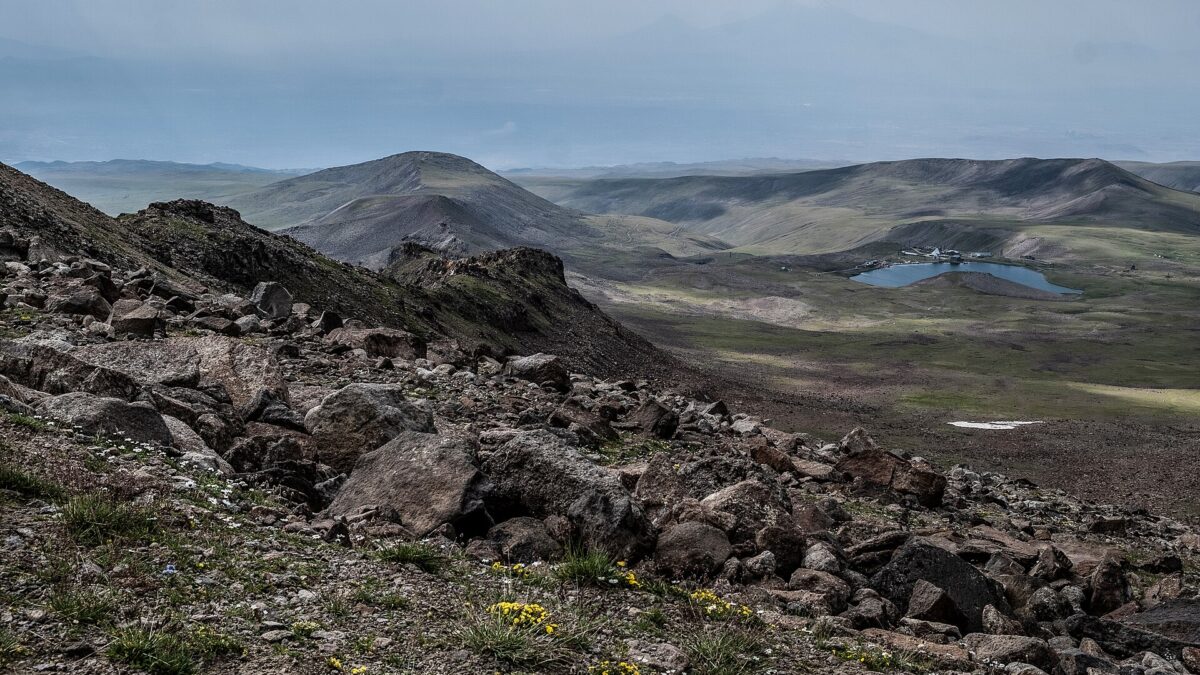
Yes. Mount Aragats is a dormant volcano and Armenia’s highest mountain, with four summits rising around a central crater: North 4,090 m (the highest point in Armenia and the Lesser Caucasus), West 3,995 m, East 3,908 m and South 3,879 m (Wikipedia). The south summit is the one non-mountaineers actually walk.
The standard route starts at Lake Kari, a small alpine lake reached by road at roughly 3,200 metres. From there the south peak is about 9 km round trip with somewhere near 680 m of ascent, on a clear, non-technical path, and most fit walkers reach the top in three to four hours. No ropes or special gear are needed (armenia-spirit.com; georgiantravelguide.com).
Two honest caveats. First, this is high-altitude walking: you are above 3,200 m the whole way, the air is thin, and weather turns fast, so start early and carry warm, windproof layers. Second, snow lingers here, and even in August a fresh dusting is possible near the top. The other three summits, and the full crater-rim traverse, are a different order of difficulty, involving scrambling and steep snow, and are best done with a guide. The south peak is the sensible goal for a strong day-hiker without mountaineering experience. Last verified: July 2026.
When is hiking season in Armenia?
Summer, roughly June to September, is the core hiking season, with the high mountains only reliably clear of snow from about July onward. Late spring and early autumn are the pleasant shoulder windows for lower and mid-altitude trails: spring brings wildflowers and green forests, while September and October offer dry, stable weather and autumn colour (Armenia Fact-Base).
A few practical calls on timing:
- High peaks (Aragats): July to September only. Snow can block the route earlier and return later.
- Forest walks (Dilijan): late April through October. August afternoons can bring thunderstorms, so hike in the morning.
- Ridge and canyon hikes (Vayots Dzor, Syunik): May and June are superb; midsummer at low elevation gets hot.
For a month-by-month breakdown of weather and festivals, see our guide to the best time to visit Armenia.
Practical tips: guides, safety and gear
A handful of things make Armenian hiking smoother and safer:
- Download the HIKEArmenia app. It is free and shows marked trails, GPS tracks, difficulty, terrain and trailhead access. Several good routes have unmarked sections, so offline navigation matters.
- Carry more water than you think. Many trails have springs, but they are not guaranteed, and summer sun on open plateau is intense. Two litres minimum for a full day.
- Consider a local guide for the bigger objectives. Guides are worth it for Aragats’ higher peaks, long TCT stretches, and remote Syunik routes. Yell Extreme Park at Yenokavan (near the Lastiver caves and waterfalls) is one established adventure operator in the northeast.
- Mind the border. Armenia’s classic hiking regions, Dilijan, Aragats, Vayots Dzor, are safe and well away from sensitive zones. Only the militarised eastern Armenia-Azerbaijan border and far-southeast Syunik near the frontier carry travel advisories, so check current guidance before planning routes in the far southeast (Armenia Fact-Base; UK FCDO, updated March 2026).
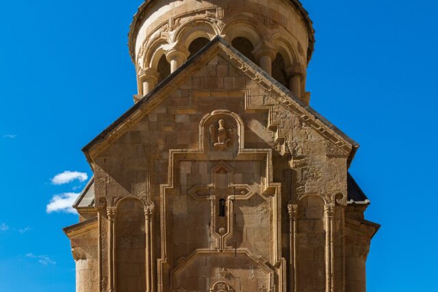
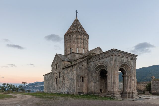
- Combine walking with monasteries. Many trails end at a church, and Tatev, above the deep Vorotan gorge, and Khor Virap, on the Ararat plain, both reward a short walk. Our best monasteries in Armenia guide pairs well with a hiking trip.
Cell coverage is decent near towns but patchy in the mountains, so tell someone your plan, download offline maps, and don’t rely on a phone signal to bail you out. With that groundwork, Armenia offers some of the most varied and least crowded hiking in the region.
Featured image: Wowan1978 (CC BY-SA 4.0) via Wikimedia Commons