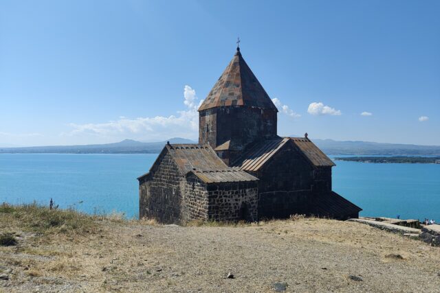
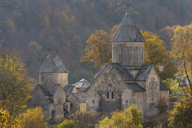
Kotavank (Կոթավանք, properly the Surb Astvatsatsin church of Kot) is a late-9th-century church on a basalt bluff above the Argichi river at the western edge of Nerkin Getashen, 5 km from Martuni on Lake Sevan’s south shore. Prince Grigor Supan of the Syunik house built it before 901 as a family church; it stood roofless from a 17th-century earthquake until a village-funded rebuild finished the dome in 2015. There is no ticket, no gate and no guide: you get a rebuilt church, a khachkar-strewn cemetery and a long view over the Sevan basin. Allow 30–40 minutes, and treat it as the first stop on a one-day loop with Vanevan and Makenyats Vank, the two other 9th–10th-century churches on this shore.
History: the Supans and the 9th-century church
The village stands on medieval Kot (Կոթ), which Armenian sources describe as the seat of the Haykazun branch of the Syunik princes and a market town on the Dvin–Partav caravan route; the AUA Hidden Gems monument record adds that 19th-century topographers counted seven churches and the ruins of houses and workshops around the modern village.
The builder was Grigor Supan, usually styled Grigor Supan II. His mother Mariam was a daughter of Ashot I Bagratuni, the first king of restored Armenia, and the wife of Vasak of Syunik; Mariam herself is credited with Sevanavank (874) and Shoghagavank, so the south shore in the 870s–890s was essentially one family’s building programme. The dating evidence is the 13th-century historian Stepanos Orbelian. The architectural historian S. Mnatsakanyan, writing in the Izvestiya of the Armenian Academy of Sciences in 1957, read Orbelian as listing Sevan, Shoghagavank, Kotavank and Makenyats as built before 901, with Kotavank finished before Makenyats, and Vanevan following in 903 when Shapuh Bagratuni, “seized by a noble envy,” decided to match his relatives. So “late 9th century” is secure; an exact year is not, and any source giving one is guessing. Orbelian also records that Supan furnished the church with precious vessels and appointed priests exempt from royal tax, per the AUA record.
The church served as the Supans’ burial place, hence the “mausoleum” label, though no identifiable princely tomb is marked on site today. The 2014 restoration report (Armenpress, carried by Asbarez, 30 May 2014) says the church stood until the second half of the 17th century, when the Garni earthquake brought down the dome and upper walls.
The Kota icon legend
The story everyone in the village tells concerns the “Holy Icon of Kot.” Tradition holds that it was made by the Apostle Thaddeus and kept at Kotavank until 1870, when it was moved to the Surb Astvatsatsin church at Sevan. The AUA record reports this as tradition, and that is how to take it: an apostolic attribution is a standard medieval device, and nothing about the icon’s age, appearance or current whereabouts could be verified for this guide. It does suggest the ruin kept a pilgrimage role into the 19th century.
What’s on site
The church
Mnatsakanyan’s 1957 description is still the best technical one. The plan is a triconch within a rectangle: semicircular apses north, south and east, a longer rectangular western arm, and a chapel in each of the four corners. The corner chapels are single-storey, but above each is a hidden chamber reached through a square hatch cut high in the east side of the north and south apses; the fitted stones that sealed those hatches have fallen out, so you can see straight in. Masonry is small, roughly dressed basalt, with larger clean-cut blocks reserved for corners and apse junctions, the typical economy of the post-Arab recovery decades. The east facade has a pair of deep triangular niches; the north and south have none, because the narrow passages into the eastern chapels are tunnelled through those walls. Two doors, south and west, with the archaic two-beam lintel-and-relieving-slit construction. The 2014 report gives the rebuilt church a height of over 20 m with a 6-m dome.
The khachkar lintel
The AUA record and tour literature both state that a 9th-century khachkar dedicated to the memory of Vardan Mamikonian, the 5th-century commander of Avarayr, is set as the lintel of the south-eastern chapel entrance. Treat that carefully. Vardan died in 451, so the stone cannot be his; at best it is an early cross-stone carrying his name. Mnatsakanyan’s survey describes the chapel lintels as plain beam constructions and mentions no khachkar, so either the stone went unremarked or it was repositioned during a restoration. Look for it, but don’t write it down as fact. For what these stones are and how to read them, see our guide to khachkars.
Cemetery and view
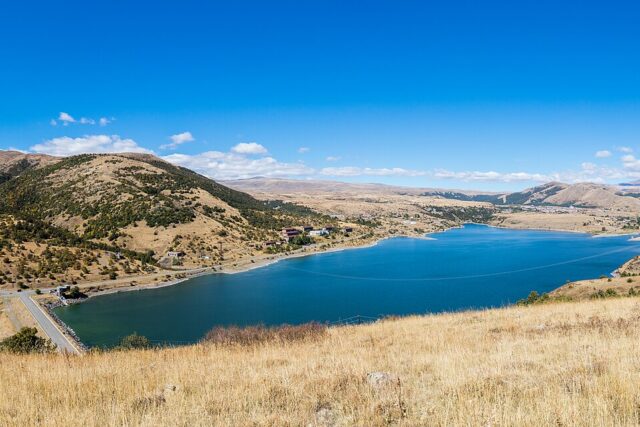
The church is ringed by a medieval cemetery that merges into the modern village one; the AUA record notes inscribed tombstones showing continuous use to the 18th century. The site is at about 1,940 m, and from the bluff you look down the Argichi to the lake and across the Martuni plain; Mnatsakanyan noted the church is “visible from great distances,” and you can spot it from the M10 before you reach the village.
Restoration, 1980s to 2015
Two campaigns. The first, in 1985–90 under the Soviet monuments directorate, raised the walls and part of the dome before stopping in 1990; the 2014 report blames poor-quality work and money running out. The second was local: in late March 2014 the Nerkin Getashen municipality, village benefactors and residents hired the Almasca construction firm, and by May the walls were at drum level with the dome under way. Mayor Karo Gevorgyan and foreman Husik Hayrapetyan promised a rebuild “without deviations or alterations”; the AUA record gives 2015 as completion. The honest caveat: this is a reconstruction, not a conservation. The drum, dome and much of the upper masonry are new, the stone is visibly fresher than the lower courses, and there is none of the patina Vanevan or Makenyats keep. If you want untouched ruins, Kotavank will disappoint; if you want a 9th-century triconch with its roof on, it is one of the few places you can see one.
Getting there
Yerevan to Martuni is about 130 km: the M4 to Sevan, then the M10 down the west shore through Gavar; reckon 2–2.5 hours. From Martuni, Nerkin Getashen begins about 2 km west along the Argichi; the church is on the far side of the village, so call it 5 km from the town centre. Ask for “Kotavank”; the hill is obvious. The last few hundred metres is a dirt track up the bluff that any car manages in dry weather, or a ten-minute walk from the village road.
Without a car: marshrutkas leave Yerevan’s Northern (Hyusisayin) bus station for Martuni through the day; the run takes around 2.5 hours and fares are in the low thousands of drams (confirm at the station; it changes). From Martuni a taxi to the church with a wait costs little, or walk it in about an hour each way. For the full loop you need wheels, because Vanevan and Makenyats sit 25 and 45 km further east with no useful public transport between them; see renting a car in Armenia.
The south-shore loop: Kotavank, Vanevan, Makenyats
These three churches were built within about thirty years by one extended family, which makes the loop coherent rather than just convenient. Do it west to east: Kotavank first (morning light on the east niches), Vanevan by late morning, Makenyats after lunch so the afternoon sun hits the carved horse on its portal. From Yerevan it is a long but feasible day if you leave by 8; better, sleep in Martuni or on the lakeshore.
| Stop | From previous | Time on site | What you get |
|---|---|---|---|
| Kotavank (Nerkin Getashen) | 5 km from Martuni | 30–40 min | Rebuilt triconch, hidden chambers, khachkar cemetery, view |
| Vanevan (Artsvanist) | ~25 km, 30 min | 45 min | 903 church with founding inscriptions, gavit, spring and cave |
| Makenyats Vank (Makenis) | ~20 km, 30 min (6 km village road) | 60 min | Supan’s second church, horse relief, big khachkar field |
| Back to Martuni | ~35 km, 40 min | Lakeside beaches on the way in summer |
Total driving within the loop is roughly 85 km and the whole thing, with stops, fills about five hours. Heading back north, Sevanavank, Mariam’s 874 foundation and the Kota icon’s supposed home since 1870, is the natural bookend.
When to go
June to early October. At nearly 2,000 m, even July needs a layer for the wind on the bluff. The dirt approach turns to mud in April–May snowmelt, and the Makenis road is a bad idea after rain. There is no resident priest, so don’t plan around a service.
Practical notes
- Free, always open, no facilities. Nearest shops and cafés are in Martuni.
- Coordinates (AUA record): 40°08’29″N 45°16’00″E. Altitude about 1,940 m.
- Bring candles if you want to light one; they are not reliably sold on site.
- The cemetery is in use. Keep to paths around recent graves and don’t climb on khachkars for photos.
- Fuel up in Martuni before the loop; Artsvanist and Makenis have nothing.
Verdict
On its own, Kotavank is a 40-minute stop that matters mainly if you care how Armenian builders relearned the dome after two centuries of Arab rule, or if you want a quiet khachkar field with a view and no coach parties. Its real value is as the first point of the Supan triangle: see all three in a day and you have watched one family’s masons improve church by church. Go with that framing, accept the 2015 dome for what it is, and it earns its place.
Last verified: October 2026. Sources: AUA Armenia Hidden Gems monument record; S. Mnatsakanyan, “New materials on the history of Armenian architecture of the 9th–10th centuries,” Izvestiya AN ArmSSR 1957 no. 2; Armenpress/Asbarez restoration report, 30 May 2014; Sevan National Park monastic complexes listing.
Frequently asked questions
Who built Kotavank and when?
Prince Grigor Supan of the Syunik house, son of Mariam Bagratuni, built it in the late 9th century. The 13th-century historian Stepanos Orbelian places it before 901 and before Supan’s second church at Makenyats; no exact year is recorded.
Is Kotavank restored or a ruin?
Restored. A 1985–90 Soviet attempt stalled; a village-funded rebuild by the Almasca firm started in March 2014 and finished in 2015, replacing the dome lost in a 17th-century earthquake. The lower walls and corner chapels are original; the upper masonry is largely new.
How do I get to Kotavank from Yerevan?
Drive about 130 km via Sevan and the M10 down the west shore to Martuni (2–2.5 hours), then 5 km west into Nerkin Getashen; the church is on the hill at the western edge of the village. Marshrutkas run from Yerevan’s Northern bus station to Martuni, then take a taxi or walk.
Can I combine Kotavank with Vanevan and Makenyats in one day?
Yes, and it is the best way to see it. Go west to east: Kotavank, then Vanevan at Artsvanist (about 25 km), then Makenyats at Makenis (about 20 km more). Roughly 85 km of driving and five hours with stops; you need a car.
Featured image: Liveon001 © Travis K. Witt, CC BY-SA 3.0 — via Wikimedia Commons.