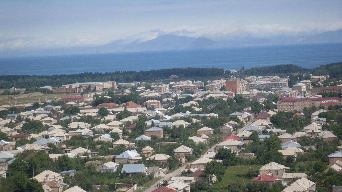
Martuni is the only town on Lake Sevan’s south shore: about 125 km and two hours from Yerevan, at roughly 1,950 m, with around 11,000 people. It is a Soviet-era market town, not a resort: a National Gallery branch, an 1886 church, a wide square, and a lakefront that the government approved for a free public beach in 2023. Its real value is as a base. From here the three Grigor Supan monasteries (Kotavank, Vanevan, Makenyats) are 5 to 35 km away, Mount Armaghan’s crater is half a day south, and the Selim pass road drops you into Vayots Dzor without going back through Yerevan.
Martuni, what it is
The settlement dates from 1830, when it was called Nerkin Gharanlugh; the medieval name of the district was Mets Kznut. In 1926 it was renamed after Aleksandr Myasnikyan, the first Soviet premier of Armenia, whose revolutionary pseudonym was “Martuni” (English and Armenian Wikipedia, cross-checked). The 2022 census counted 11,287 residents, down from 12,894 in 2011.
Two orientation facts matter. The town centre sits about 2 km back from the water across flat pasture; the lakeshore strip with the cafés is a separate cluster off the M10. And Martuni is a junction: the M10 runs east along the shore to Vardenis, west to Gavar and Sevan town, and the Yeghegnadzor road climbs south over the Vardenyats (Selim) pass. Whatever you do on this side of the lake, you pass through here.
In town: gallery, church, square
Martuni Art Gallery
One of the National Gallery of Armenia’s 12 regional branches. It was set up in 1978 with works supplied by the Ministry of Culture’s mobile art studio and holds about 200 items (paintings, sculpture, graphics) covering Armenian art of the 1960s to 1980s (gallery.am branch page). A small, uncurated slice of late-Soviet Armenian painting, which is rarer than it sounds. The National Gallery lists it at Shahumyan 6. Opening hours are not reliably published; expect weekday hours, a Monday closure, and possibly a locked door with a phone number on it. Ring the National Gallery in Yerevan before detouring for it.
Surb Astvatsatsin, 1886
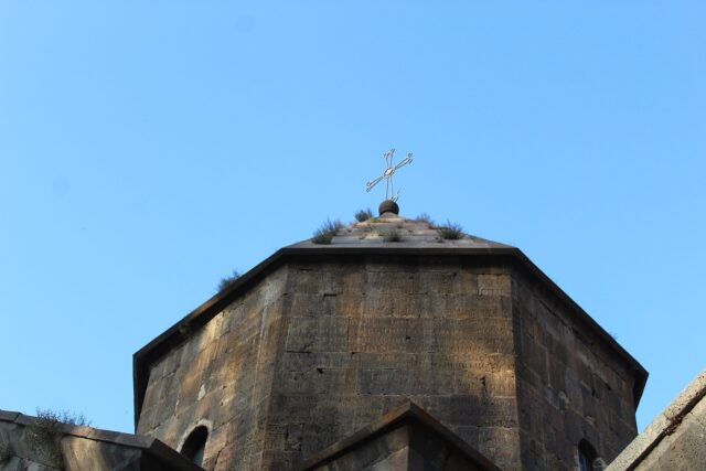
The parish church is a plain late-19th-century basalt building of the type that went up across the Sevan basin under Russian rule. A working church, usually open, with a cemetery that reads as the town’s history. The Armenian Wikipedia article mentions a wooden cross with a carved cross-stone found inside a tree trunk, now kept in the gallery.
The square
Martuni’s centre is a textbook small-town Soviet layout: a long main street, a wide square with the House of Culture and municipality, tuff and basalt apartment blocks from the 1960s to 1980s, most of it unrestored. The lower streets toward the lake have the bazaar, bakeries and the marshrutka stand. The honest caveat: nobody comes to Martuni for Martuni. Ninety minutes and a coffee, then use it.
The beach and the lake: rules, water, season
Lake Sevan’s free public beaches are run through the Ministry of Environment and Sevan National Park, and for years all eight were on the north and west shores: two in Sevan town, the peninsula beach, Drakhtik, Lchashen, Tsovazard, Noratus and Tsovagyuh (ARKA; EcoLur). On 13 July 2023 the government approved four new public beaches adjacent to Lchap, Shoghakat, Gavar and Martuni, 4.2 hectares combined, to be handed to operators by competition on condition that the core services stay free (EcoLur, 13 July 2023).
“Free public beach” has a published meaning here: free entry, changing rooms, toilets and washrooms, a first-aid post, lifeguards, a children’s playground and rubbish collection. Loud music and smoking are banned on the sand; beer is tolerated. The season opens officially on 1 July with eco-patrol and water-rescue teams on duty; in 2025 the ministry opened five public beaches that day (ARKA, July 2025).
The honest caveat: I could not confirm from an official list that the Martuni beach was among those equipped and opened in 2024 or 2025. Treat the Martuni lakefront as a basic shore where locals swim, with paid cafés and loungers nearby, and check with the municipality or Sevan National Park before promising anyone a lifeguarded beach.
The water is the same on every shore. Sevan sits at 1,900 m and warms only to 18–20 °C in July and August, nudging 22 °C in shallow bays (Sevan National Park; X-Waters open-water swim data). June is bracing, September is possible on a sunny afternoon. The south shore is shallower and sandier than the rocky peninsula side. Sun at this altitude is severe.
Eating fish at Sevan: the honest version
Every café on the M10 advertises ishkhan. Here is what you are being sold.
- Ishkhan (Sevan trout, Salmo ischchan) is endemic, listed in Armenia’s Red Book, and catching it in the lake is prohibited. Of its four subspecies, two (winter bakhtak and bojak) are extinct; summer bakhtak and gegharkuni survive through state hatchery breeding (Hetq, September 2020; EcoLur, December 2023). Wild lake ishkhan is a poached product.
- What is on the grill is farmed trout. The state-linked Sevan Aqua operation rears Sevan trout in cages and is the only legal source of the species (Hetq); much of what is sold as ishkhan is plain rainbow trout from the Ararat valley. Honest food, but not a wild endemic fish, and no menu will say so.
- Sig (whitefish), introduced in the 1920s, is the lake’s everyday fish. It is fished under an annual government quota (314 tonnes for 2025, through 1 June, decision of 30 January 2025) with a total catch-and-sale ban during spawning, 25 November to 20 January (EcoLur). Grilled or smoked sig in season is the genuinely local plate; in December it is contraband.
- Crayfish are on the recreational-fishing list and cheap; boiled with dill in a Martuni café they are the best thing on this shore.
Prices here are lower than at the peninsula. Ask what the fish is and where it came from; “farm” or “sig” is a good answer.
Aghjaghala and the hills
Aghjaghala is a small medieval castle on a summit above the Argichi valley south-west of Martuni, catalogued as 10th–13th century in the standard list of Armenian castles. It is a rubble-wall mountaintop fort with no road, no sign and no interpretation: drive toward Nerkin Getashen and the Argichi gorge, park where the track ends, and climb for about an hour on sheep tracks. Expect more wall-line than wall, a view down the river to the lake, and nobody else. The dating comes from survey literature, not an inscription, so treat “10th century” as the earliest plausible date. The 1997 Armenian-Italian excavation of an Iron Age fort at Martuni itself shows how long this valley mouth has been defended.
The south-shore loop from Martuni
This is the reason to sleep here. Three monasteries tied to the 9th-century prince Grigor Supan II sit along the shore east and west of town,, the least-visited medieval sites on Sevan. Each has its own page here; the table gives the logistics.
| Site | From Martuni | Drive | Time on site |
|---|---|---|---|
| Kotavank, Nerkin Getashen | 5 km west, on a bluff above the Argichi | 10 min | 30–40 min; khachkar cemetery and the view |
| Vanevan, Artsvanist | ~20 km east on the M10, then into the village | 25 min | 45 min; 903 church, possible tomb of King Smbat I |
| Makenyats Vank, Makenis | ~35 km east to the turn-off, then up the valley | 45 min | 45–60 min; 9th-century monastic school, restored |
As a loop (Kotavank first, then east to Artsvanist and Makenis, back along the shore) it is about 90 km and a comfortable six-hour day with lunch at a lakeside café near Artsvanist. Fuel and cash in Martuni before you start; Artsvanist and Makenis have a shop each and no ATM.
Over the Selim pass
The road south from Martuni to Yeghegnadzor is the M10 continuing over the Vardenyats pass, 2,410 m, which the road bulletins still call Selim. From Martuni it is roughly 30 km of steady climb through Lernahovit and Geghhovit to the top, with the 14th-century Selim caravanserai just below the summit on the Vayots Dzor side, then a long descent; call the whole crossing 65–70 km and about 1.5 hours in dry weather. It links Sevan with Noravank, Areni and the road to Syunik without touching Yerevan.
The caveat is winter. Armenpress and ARKA publish the closures: the pass shuts in snowstorms from roughly November to April, sometimes for days. From May to October a normal car is fine.
Mount Armaghan is a detour off the same valley: from Lernahovit continue to Madina and then along the track toward the mountain. Armaghan is an extinct volcano of 2,829 m with a small crater lake (about 150 m across, 15 m deep) and a basalt chapel built in 2009 on older foundations (ArmGeo). The final 5–6 km from the end of the track is a walk of about 500 m of ascent (Hiking Project); a jeep gets most of the way. Half a day from Martuni.
Getting there
- By car: Yerevan to Martuni is about 125 km: M4 to Sevan town, then the M10 down the west shore through Gavar, 2 to 2.5 hours. From the south, Yeghegnadzor over the pass in about 1.5 hours.
- By marshrutka: Minibuses to Martuni leave Yerevan’s Northern (Hyusisayin) bus station through the day, around 2.5 hours; the timetable aggregator t-armenia.com lists Martuni from the Kilikia (Central) station instead, so ask at your guesthouse the day before. Cash to the driver; last return mid-afternoon.
- Along the shore: Gavar–Martuni–Vardenis marshrutkas run the M10 and will drop you at Artsvanist or the Makenis turn-off, but return times are unpredictable; a Martuni taxi for the loop with waits is the practical carless option.
Where to stay
Martuni has a few guesthouses and small hotels in town and on the lakeside strip, with more toward Artsvanist and Tsovinar. I have not verified any by name and will not recommend one blind; book on the usual platforms, filter by recent reviews, favour the lakeside in July and August. Many close out of season.
Practical notes
- Altitude about 1,950 m: nights are cold even in July.
- Season: July and August for swimming; late May to June and September to early October for the monasteries and the pass.
- Cash: ATMs in Martuni and Vardenis; nothing between.
- Fish: ishkhan on a menu is farmed; sig is legal in season, banned 25 Nov to 20 Jan; do not buy fish from a car boot on the shore.
- Beach: check the current year’s list of opened public beaches with the Ministry of Environment before relying on lifeguards and toilets at Martuni.
- Last verified: October 2026.
Verdict
Martuni is a one-coffee town and a three-day base. Skip it on the Yerevan–Dilijan–Sevanavank circuit; use it if you want Sevan’s medieval south shore, a crater volcano and the Selim pass with almost no other visitors. For the whole lake, see our Lake Sevan guide.
Frequently asked questions
Is there a free public beach at Martuni?
The Armenian government approved a free state-run public beach adjacent to Martuni on 13 July 2023, alongside Lchap, Shoghakat and Gavar, with free entry, changing rooms, toilets and lifeguards once equipped. We could not confirm from an official list that it was among the public beaches opened in 2024 or 2025, so verify the current season with the Ministry of Environment or Sevan National Park.
Can you legally eat Sevan trout (ishkhan) in Martuni?
Only farmed. Sevan trout is in Armenia’s Red Book and catching it in the lake is prohibited; the only legal supply is cage-reared trout, and many cafes serve rainbow trout under the name. Whitefish (sig) is legal in season under a government quota but banned, including sale, from 25 November to 20 January.
How far is Martuni from Yerevan and how do I get there without a car?
About 125 km by road via Sevan town and the west shore, 2 to 2.5 hours by car. Marshrutkas run from Yerevan’s Northern bus station through the day (some timetables list the Kilikia station), taking around 2.5 hours; confirm the station locally the day before.
Is the Selim (Vardenyats) pass from Martuni open all year?
No. The pass is at 2,410 m and closes in snowstorms from roughly November to April, sometimes for days; Armenpress and ARKA publish daily road bulletins. From May to October a normal car crosses from Martuni to Yeghegnadzor in about 1.5 hours, passing the Selim caravanserai just below the summit.
Featured image: Spetsnaz1991, CC BY 2.0 — via Wikimedia Commons.