Berd is the only town in Shamshadin, the far north-eastern pocket of Tavush that pushes toward the Kura valley and the Azerbaijani border. It is worth a day or two for three things: the ruined 10th-century Tavush fortress on its rocky hill above the river, the Kyurikid monastery of Nor Varagavank with the most elaborate carved portal in the province, and a close look at what a working Armenian border town is actually like. The honest caveat: Berd is 4 to 5 hours from Yerevan, the third big monument (Khoranashat) needs a permit, and the sights are ruins rather than restored showpieces. Come for the history and the hills, not for comfort.
Berd and Shamshadin: what and where
Berd (“fortress” in Armenian) sits on the Tavush River at roughly 930 m, about 54 km east of Ijevan by road and 200 to 210 km from Yerevan depending on which route you take (Armenian-language municipal and encyclopaedia figures give 202 km; other sources round to 211). The 2022 census counted 6,899 residents, down from 7,957 in 2011. Beekeeping, berries, tobacco and potatoes are the traditional earners.
The regional name, Shamshadin, is not Armenian. It comes from the Shamshadil sultanate, a semi-autonomous district set up in 1747 and named after the Turkic Shamshaddinlu tribe that then dominated the area. The Soviet raion kept the name (1929 to 1995), and locals still use it. Shamshadin is three parallel valleys (Hakhum, Tavush, Khndzorut) running north off the Miapor range toward the Kura; that geography explains both the isolation and the long border.
Russian-language readers may know it as the setting of Narine Abgaryan’s Manunia books.
The Tavush fortress: history, what’s left, the climb
The fortress occupies a steep rocky hill in the south-east of town on the right bank of the Tavush River, with the citadel rock at about 960 m. Nobody has found a foundation inscription, so the dating is argued from chronicles. Historian Artashes Shahnazaryan (Yerevan State University, Armenological Issues 25, 2022) argues it was most likely built by Smbat I Bagratuni between the mid-890s and the early 900s; the American University of Armenia’s heritage database is more cautious and simply calls the founder unknown.
The first secure mention is the 921 revolt of Tslik Amram, governor of Utik, who sheltered his family in the fortress while fighting King Ashot II Yerkat; the chronicler Hovhannes Draskhanakertsi records the royal army being beaten back. After the Bagratid collapse in 1045 the site passed through Byzantine, Kyurikid, Seljuk and Vahramian hands. Under the Kyurikids, the junior Bagratid line that ruled Lori and Tavush, it was the administrative centre of their Tavush domain. The Mongols took and wrecked it in 1236, and by the late 14th century it was abandoned.
The archaeology is recent and ongoing. Excavations ran in 1986 to 1988 and again from 2020 under the Institute of Archaeology and Ethnography. The key find from 1988 is a five-line inscription naming the church inside the walls as Surb Astvatsatsin, built in 1019, destroyed by the Gandzak earthquake (sources give 1138 or 1139) and rebuilt the following year by the Kyurikid ruler Abas. The 2020 to 2022 seasons turned up pottery, tombstones and a coin of the Shaddadid emir Fadl I (985 to 1031).
What you see today, per the AUA monument record: the northern walls of the citadel on the summit, stretches of the lower fortress wall with semi-circular towers, the church foundations on the eastern slope, rock-cut cisterns or wells south of the church, and in the lower fortress a run of cyclopean-style masonry that may predate the medieval work. The whole enclosed area is about 13 hectares; the citadel itself is tiny, around 500 square metres. Allow 45 to 90 minutes from town. No ticket, no useful signage, no railing; wear real shoes.
In town: cyclopean walls, museum, park
Berd was settled long before the fortress. The central park sits on traces of a cyclopean (Bronze or Iron Age) wall, and burials dug there yielded large clay vessels, iron weapons and glass beads of the 5th to 4th centuries BC, per the Rediscovering Armenia guide and the national tourism board’s monument list. Expect low courses of unworked boulders, not a visible fortress.
The town museum opened in 1981 as a branch of the Sardarapat ethnography museum and now operates under the “Berd” Historical and Cultural Reserve, which also oversees the fortress. The collection is archaeological and ethnographic material from Shamshadin. Hours are elastic; ask at the municipality or your guesthouse to get it opened.
Nor Varagavank
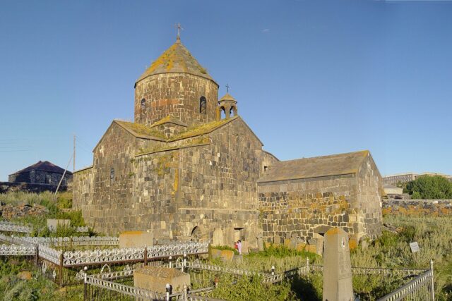
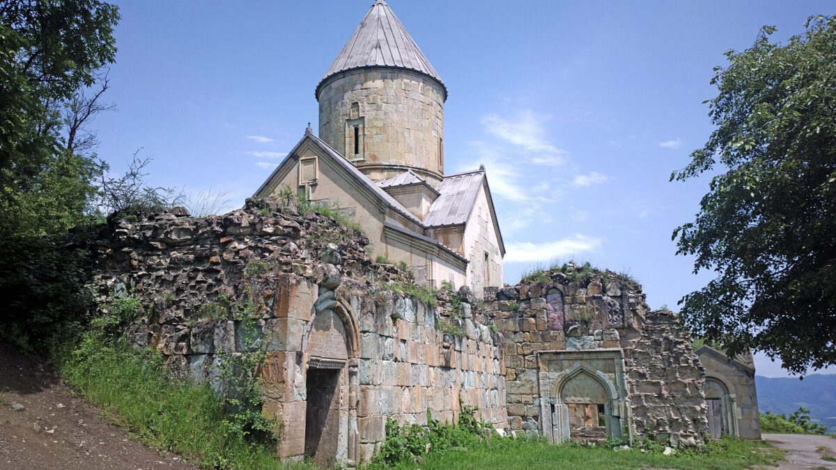
This is the monument to come for. Nor Varagavank stands on a forested hillside about 3.5 km south-west of Varagavan village, which is itself a short drive west of Berd. The oldest building, the small Anapat church, was put up in 1198 by Prince David; his descendant Vasak then built the main Church of the Holy Mother of God between 1224 and 1237, with consecration recorded in 1240. Sources name the architect as a master from Ani, variously given as Hovhan or Gazan, so take the name loosely. The complex also has a burial chapel, two gavits (the western one among the largest of its type in Armenia), two outlying chapels in a medieval cemetery, and khachkars including one signed by master Vardan in 1620.
The reason specialists make the trip is the western portal of the main church: a deep-relief frame carved in alternating red, black and ochre stone, dense with interlace and rosettes, in a style that reads as a provincial cousin of the great portals at Haghartsin and Goshavank. Anyone who has seen Haghartsin will recognise the 13th-century Tavush school. The monastery took its present name after monks from the famous Varagavank near Van brought a relic of the True Cross here when the Mongols threatened Vaspurakan (sources give 1213 or 1237 for the transfer); “Nor” simply means new. It is standing but unrestored; the last track from the village is dirt, fine for a normal car in dry weather.
Khoranashat and the border question
Khoranashat is the other great Kyurikid-era monastery of Shamshadin, and the one you will probably not see. It stands on a hill about 1 km north-east of Chinari village and, by the Google Arts & Culture / heritage survey’s measurement, roughly 500 m from the Azerbaijani border. Vanakan Vardapet (1181 to 1251), a pupil of Mkhitar Gosh, founded it between 1211 and 1222 and ran his theological school here until his death; the 800th anniversary was marked in May 2022. Two buildings survive, the domed Surb Astvatsatsin with its four-column gavit and the small St Kiraki chapel, both in a severe state per the 2020 heritage survey.
Access is the problem. Chinari was shelled in July 2020, and the hill faces Azerbaijani positions directly. Visits require a permit arranged through the Armenian military; the 2022 anniversary pilgrims went up accompanied by soldiers, and the few tour operators who run the 6 km round-trip hike from Chinari state that permits are obtained for the group on the day. Independent visitors should not walk up on their own and should not approach any border position for a closer look. The August 2025 Washington declaration, in which Armenia and Azerbaijan initialled (not yet signed) a peace treaty, has not translated into open access as of this writing. Ask at the Berd municipality or the Diocese of Tavush, and accept a no. Read our piece on whether Armenia is safe for tourists for the wider picture.
Soranner dendropark and the hills
Soranner is a small state arboretum on the edge of town (52A Saralanj Street) run under the Ministry of Environment, planted with regional and introduced tree species and kept as a quiet walking park. The ministry’s own write-up gives no area or species count I trust; it is a pleasant hour, not a destination. The real draw around Berd is the forest. The ridges hold oak, beech and hornbeam woodland, and in July and August villages sell wild raspberries, blackberries and cornelian cherry by the bucket; see our guide to Armenian wild berries. The mid-August Honey and Berry Festival is the one event that draws outside crowds.
The hiking is good and almost entirely unmarked. The useful rule: stay on the Berd and Ijevan side of the ridges and keep away from the eastern valley floors near Aygepar, Movses, Chinari and Nerkin Karmiraghbyur unless a local is with you. Those are the villages that took fire in 2020.
Getting there: Yerevan to Ijevan to Berd
Everything comes through Ijevan. Marshrutkas leave Yerevan’s Kilikia central bus station for Ijevan through the day (about 3 hours); from Ijevan’s bus stand there are a few minibuses a day to Berd plus shared and private taxis. Budget 4 to 5 hours door to door; confirm the Ijevan to Berd departure the day before, because the last minibus leaves early. Our guide to getting around Armenia covers the marshrutka system in detail.
Driving: from Ijevan there are two roads to Berd, the longer paved route via Navur (H-36) and a shorter, rougher mountain road. A 35 km renovation of the Navur to Berd to Aygepar road (about 3.9 billion AMD; the PM inspected it in April 2026) is under way, so expect roadworks and occasional closures. A standard rental car is fine in dry conditions.
| Leg | Distance | Time | Notes |
|---|---|---|---|
| Yerevan to Ijevan | ~140 km | 2.5 to 3 h | Marshrutka from Kilikia; M-4 via Dilijan |
| Ijevan to Berd | ~54 km | 1 to 1.5 h | H-36 via Navur; works ongoing 2025 to 2026 |
| Berd to Nor Varagavank | ~15 to 20 km | 30 to 45 min | Paved to Varagavan, then dirt track |
| Berd to Chinari (Khoranashat) | ~15 km | 30 min | Permit required for the monastery; do not freelance |
When to go
May to June for green hills and empty roads; late July to August for berries and the festival, with afternoon storms; late September to October for beech colour and the clearest views from the fortress. Winter is workable but the Varagavan track turns to mud.
Where to stay and eat
Hotel Berd at 1 Levon Bek Street is a remodelled Soviet four-storey block and the only conventional hotel in town; it is cheap and adequate. Guesthouses are the better option: several family places in Berd list on the booking platforms, and the Tanik guesthouse in Artsvaberd village was written up by regional media. Food is home cooking plus honey and mulberry vodka from the market; there is no restaurant scene, so eat where you sleep.
Practical and safety notes
- Carry your passport. There are police and military checkpoints on the roads east of Berd, and you may be asked where you are going.
- Do not photograph military posts, soldiers or anything with an antenna. This is enforced.
- Coverage is fine in town, patchy in the valleys; download offline maps. Carry cash.
- The fortress has no barriers. Keep children close on the citadel rock.
- The border situation in late 2026 is calm but not settled. Check the latest before travelling, and defer to locals on where not to walk.
Last verified: October 2026.
Verdict
Berd rewards people who like their history unpolished. Nor Varagavank alone justifies the detour from Dilijan or Ijevan if you care about medieval carving, and the fortress climb shows you why a Bagratid king wanted a stronghold here. Pair it with Dilijan for a three-day Tavush loop, and leave Khoranashat for the day the permit comes through.
Frequently asked questions
Who built the Tavush fortress in Berd?
No foundation inscription survives. The leading recent study (Shahnazaryan, Yerevan State University, 2022) attributes it to King Smbat I Bagratuni in the late 890s or early 900s; other heritage records list the founder as unknown. It is first securely mentioned in 921, later served the Kyurikid dynasty as an administrative centre, and was destroyed by the Mongols in 1236.
Can tourists visit Khoranashat monastery?
Only with a permit arranged through the Armenian military, usually via an organised group or the Diocese of Tavush. The monastery is about 500 m from the Azerbaijani border above Chinari village. Do not attempt it independently; confirm the current position locally before you travel.
How do I get from Yerevan to Berd without a car?
Take a marshrutka from Yerevan’s Kilikia bus station to Ijevan (about 3 hours), then a minibus or shared taxi from Ijevan to Berd (about 1 to 1.5 hours). Confirm the Ijevan to Berd departure time the day before; the last one leaves early.
Is Berd safe to visit in 2026?
The town and the roads to Nor Varagavank are calm, and the August 2025 Washington declaration between Armenia and Azerbaijan reduced tension. The border strip east of Berd remains militarised. Stay away from border positions, carry your passport for checkpoints, and check recent news before you go.
Featured image: Soghomon Matevosyan, CC BY-SA 4.0 — via Wikimedia Commons.