Kosh is a village of about 2,500 people on the Yerevan–Gyumri road, roughly 40 km from the capital, with a compact 13th–14th-century fortress on the hill above its cemetery, a ruined 13th-century church, a 19th-century one still in use, an 18th-century oil press and a 6.8-metre khachkar from 1195 that marks the end of Seljuk rule in Aragatsotn. None of it is excavated, signposted or ticketed. You park below the cemetery, walk up in ten minutes, and get the fortress and a clear line to Ararat to yourself. It is a two-hour stop, not a day; pair it with Oshakan, Aruch or Agarak and it becomes a very good one.
Kosh in history
The site is older than anything you can see standing. Early Iron Age residential ruins and walls of large basalt blocks are scattered around the hill (Armenian heritage listings; AUA Hidden Gems), and the castle has yielded Hellenistic pottery. The first written mention is 5th-century: Movses Khorenatsi records that the blinded Arsacid king Tiran withdrew to the town of Kuash “at the foot of the mountain called Aragats”, and later passed the estate to his grandson Gnel (Khorenatsi, Book III, ch. 22). Kuash is Kosh; AUA’s heritage database adds that Vasak Syuni sacked it in the 450s. A 7th-century cross-domed church, Surb Stepanos, survives in the gorge nearby with fragments of fresco; AUA dates it to the first half of the 7th century with repairs in 921 and 1347.
The medieval fortress belongs to the Zakarid revival. After the Seljuk century, Armenian-Georgian armies under the Zakarian brothers pushed the Turkic emirs out of the Ararat plain and Aragatsotn in the 1190s, and the 1195 khachkar south of the village records exactly that. The fortress in its present form is dated to the 13th–14th centuries by Armenian sources, though AUA argues (from the change in masonry) for an early-medieval foundation that was heavily rebuilt in the 13th–14th.
The fortress — plan, towers, the climb
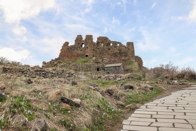
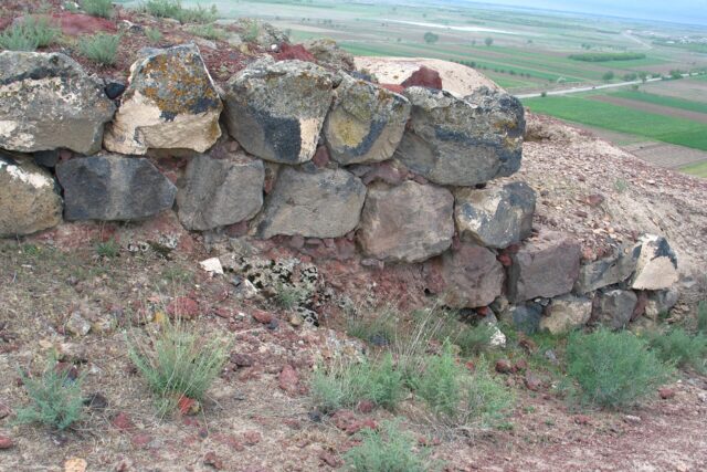
Koshaberd sits on a rocky knoll at the northern edge of the village, about 1,250 m above sea level, directly above the cemetery. The plan is a near-rectangle with a semicircular tower at each corner; the lower courses are rough basalt, the upper walls dressed reddish tuff, and that switch of material is the main dating evidence anyone has, because no proper excavation has been done (AUA Hidden Gems). Sources disagree on the entrances: AUA says a single gate on the south side; the Armenian heritage description used by Armland and others says gates on both north and south with roofed corridors behind them.
The detail everyone repeats is that two of the four corner towers are hollow and are “assumed” to have doubled as water cisterns (Armenia Discovery, citing the local heritage inventory). The honest caveat: it is an assumption, not an excavated fact. There is no visible plaster lining and no published measurement of the chambers. Plausible — a hilltop fort with no spring needs stored water — but a hypothesis.
Inside the walls are the footings of basalt-built rooms, mostly knee-high. The whole enclosure takes five minutes to walk around. The point of coming is the walls themselves, which stand close to full height on the south and west, and the view: Ararat to the south across the Ararat plain, Aragats behind you, the Yerevan–Gyumri road threading between.
The climb from the cemetery is ten minutes on an obvious path, loose scree near the top. No railings; the north side drops sharply.
The Maiden’s fortress legend
Locals call it Aghjkaberd, the Girl’s Fortress, and the story attached to it is a standard Armenian siege legend transplanted onto Timur (Lenk Temur, who campaigned here in the 1380s–1400s). A beautiful girl lived in the fortress; Timur wanted her; his assaults failed; his men finally cut off the water; rather than surrender she threw herself from the walls. That is the version given by Armenia Discovery and by the Hamshen tour operator who runs hikes here. Armland has her jump “into the river”, odd given there is none below the fortress. It is a legend. There is no record of Timur besieging Kosh specifically.
The 1195 khachkar
South of the village, by the old road, stands a red tuff khachkar 6.8 m high — among the tallest in Armenia — dated by inscription to 1195 and dedicated, in the Armenian heritage listing’s wording, to the liberation of Aragatsotn from the Seljuk Turks. AUA’s database calls it the Petros Akanates cross-stone and places it “on the Yerevan–Gyumri road”; the English Wikipedia village article gives 1175 and says it stands in the hilltop cemetery. Two sources (the Armenian heritage listing and the Armenian Wikipedia entry, which cite the monument inventory) agree on 1195 and 6.8 m, so that is the figure to trust; the 1175 date looks like a transcription error. The Zakarids’ recapture of the Ararat plain is normally put at the 1190s, which fits 1195 and not 1175.
It is a commemorative monument, not a tombstone — a distinct category explained in our khachkar guide — and it has weathered badly on the windward face.
The churches and the oil press
| Monument | Date | What survives |
|---|---|---|
| Surb Grigor | 13th–14th c. | Single-nave, barrel-vaulted; roof partly collapsed, walls standing |
| Surb Gevorg | 19th c. | Intact, in use; dressed tuff on basalt foundations |
| Oil press (dzitan) | 18th c. | Vaulted stone hall, 4.8 × 13.5 m, 2.8 m high |
| Surb Stepanos | 7th c. (repairs 921, 1347) | Cross-domed church in the gorge, fresco fragments |
Surb Grigor is a plain single-nave hall of the kind village Armenia built by the hundred in the Zakarid period, and it is in poor shape — go in for the vault profile and the few carved stones reused in the walls. Surb Gevorg, the working church, is a 19th-century rebuild; the Armenian Wikipedia entry describes it as a rectangular “fortress-church” with round corner towers, which I could not confirm from a second source, so look for yourself. The oil press is the surprise: an 18th-century vaulted stone building, 4.8 by 13.5 metres and 2.8 metres high (dimensions from the Armenian heritage inventory via hy.wikipedia), where flax or sesame was crushed under a stone wheel. Most Armenia itineraries skip buildings like this entirely. Surb Stepanos is a 15–20-minute walk down into the gorge and worth it if you have time; the 7th-century masonry is the finest at Kosh.
The walk to Ujan/Avan
Kosh sits between two other villages with their own ruins. Ujan (historically Vzhan), 3 km east, has the Motkan cyclopean fortress on a hill above it; Avan, a few kilometres west, has an early Christian church. The Hamshen tour company runs this as a guided easy hike — Ujan fortress, Kosh fortress, Surb Stepanos, Avan — and quotes 5 km on foot for the loop sections, with a 09:00 departure from Yerevan and 6,500 AMD per person including the minibus (2026 price, Armenian-language guiding with English summaries on request). Self-guided, the Kosh–Ujan leg is a flat walk on farm tracks with Aragats on your left; allow an hour each way. No marked trail; download offline mapping first.
Getting there (Yerevan → Ashtarak → Kosh)
By car: take the M1 northwest out of Yerevan past Ashtarak (about 20 km), stay on the Gyumri road, and Kosh is signed on the left roughly 20 km later; Rome2Rio puts the road distance at about 41 km and 36–40 minutes. The fortress is at the top (north) end of the village; drive through to the cemetery and park.
By public transport, there is no direct Yerevan–Kosh marshrutka listed. Minibuses run from Kilikia bus station to Ashtarak (about 40 minutes) and onward services along the M1 toward Talin and Gyumri pass the Kosh junction; ask the driver to drop you at “Kosh” and walk 1.5 km up into the village. Coming back, flag anything heading toward Yerevan from the junction, or take a taxi to Ashtarak.
A half-day taxi from Yerevan (Kosh plus Oshakan, waiting included) runs roughly 15,000–20,000 AMD; agree the price first.
Pair it with
- Oshakan — the tomb of Mesrop Mashtots, inventor of the alphabet, 15 minutes back toward Ashtarak. The natural pairing.
- Aruch — the 7th-century cathedral and the medieval caravanserai, 15 km further along the Gyumri road.
- Agarak — the rock-cut Bronze Age landscape just past Kosh toward Aruch.
- Mughni — Surb Gevorg (17th c.) with its chequered drum, in Ashtarak’s northern suburb.
Kosh–Oshakan–Mughni is a comfortable half day; add Aruch and Agarak and it fills a full one.
When to go / light
The fortress faces Ararat to the south, so the classic shot — tuff walls with the mountain behind — wants morning light from the east side of the hill, before haze builds over the plain. Ararat is clearest October to April; in July–August it is often invisible by 10:00. Late April–May gives green slopes; winter is fine but the scree ices. There is zero shade in summer.
Practical notes
- Free, unfenced, open at all hours. No facilities at the fortress; a small shop and a bakery in the village.
- Allow 1.5–2 hours for the fortress, khachkar, churches and press; add an hour for Surb Stepanos in the gorge.
- Monument condition: the fortress is unexcavated and unrestored. The state heritage service’s endangered-monument monitoring covers Aragatsotn, but I could not access Kosh’s current entry; do not lean on the walls.
- The cemetery is in use. Walk round, not across, graves; photograph the khachkars, not mourners.
- Dress modestly if entering Surb Gevorg; it is a working parish church.
Last verified: October 2026.
Verdict
Kosh is a 20-minute detour off a road you are probably driving anyway, and it gives you four centuries of stone in a walkable square kilometre plus the best Ararat-and-Aragats double view on the western side of Yerevan. It is not Amberd; the walls are lower and the setting gentler. But Amberd is 2,300 m up and shut by snow half the year. Kosh is open every day and, nine times out of ten, empty.
Frequently asked questions
How far is Kosh from Yerevan and how long does it take?
About 41 km by road on the M1 (Yerevan–Gyumri highway) past Ashtarak; 35–45 minutes by car. There is no direct marshrutka — take a minibus toward Ashtarak, Talin or Gyumri and get off at the Kosh junction, then walk 1.5 km up into the village.
Were the fortress towers really water cisterns?
Two of the four corner towers are hollow and Armenian heritage descriptions assume they stored water. No excavation has confirmed it and no lining or measurements are published, so treat it as a plausible hypothesis, not a fact.
Is the Kosh khachkar from 1195 or 1175?
Most Armenian sources, including the monument inventory, give 1195 and a height of 6.8 m; one English-language source gives 1175. The 1195 date also matches the Zakarid liberation of Aragatsotn from the Seljuks, which the inscription commemorates.
Is Kosh worth visiting on its own?
As a two-hour stop, yes; as a day trip, pair it. Oshakan (Mesrop Mashtots’ tomb), Aruch cathedral and the Agarak archaeological site all lie on the same road within 20 minutes.
Featured image: Vacio, CC BY-SA 3.0 — via Wikimedia Commons.