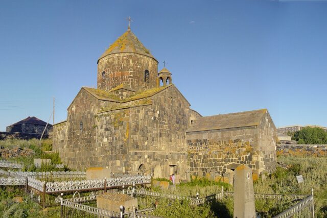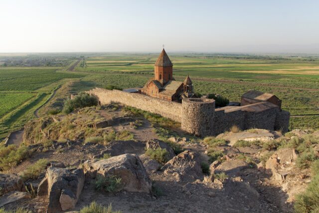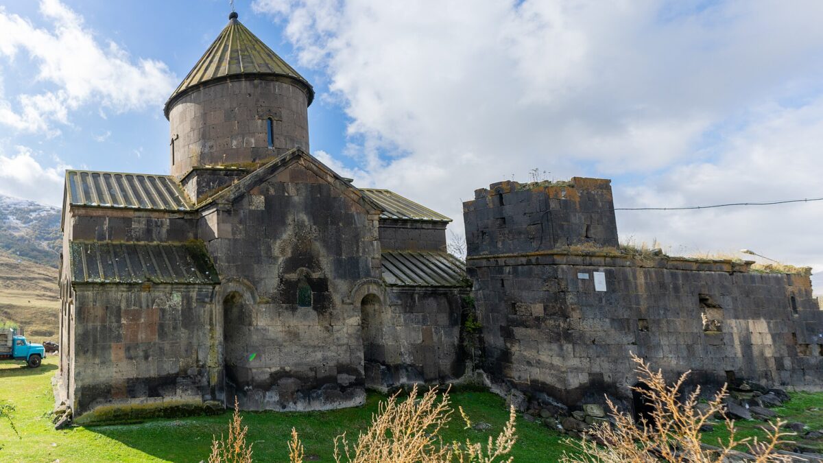
Yeghipatrush is a village of about 800 people at 2,000 m on the south-east side of the Aparan reservoir, roughly 50 km north of Yerevan, and it holds one of the strangest 13th-century buildings in Armenia: a Surb Astvatsatsin church whose gavit lost its roof and south wall long ago, leaving a four-column hall open to the sky with two tower-like chapels still standing on its corners. The complex was built under Vache Vachutyan, the prince who also paid for Saghmosavank, Hovhannavank and Tegher, and an inscription dated 1208 fixes the church to the first decades of the 1200s. There is no gate, no ticket, and until now no proper English guide to it.
The Vachutians and 1208
After the Zakarian brothers retook northern Armenia around 1200, they handed Aragatsotn and the Nig district (the Aparan basin) to Vache Vachutyan, whose dynasty ruled here until the mid-1300s. The Courtauld “Crossing Frontiers” project records the Saghmosavank inscription naming “Prince of Princes Vache Vachutyan and his wife Mamakhatun” as patrons of its church in 1215; the same couple built Tegher (church 1213, gavit 1221) and Hovhannavank.
Yeghipatrush belongs to this burst. The decisive evidence is a donation inscription cut on three stones of the church’s south wall, dated ՈԾԷ, Armenian year 657, which converts to 1208. Two of the stones now sit inside the church; the third vanished in the 1920s. The epigraphist V. M. Petrosyants, who published the site’s inscriptions in the Armenian Academy’s Historical-Philological Journal, dates the church to the 1210s–1220s under Vache and the gavit to the late 1220s, in step with Tegher’s. He retracted his own earlier attribution to Vache’s son Kurd, a version still repeated in some Armenian summaries; the 2023 Masaryk University study by Annalisa Moraschi follows the Vache dating.
The honest caveat: no building inscription survives; the door lintel is weathered to a few letters. “Early 13th century, Vachutian patronage” is solid; “1208” is the date of a gift, not a foundation stone.
The church
Surb Astvatsatsin is a sizeable domed church of red and brown tuff: square outside, cross-shaped inside, with two-storey chambers in all four corners carrying the dome. The dome’s pointed cap is gone and the west wall has lost facing stones and cracked, but the other three walls stand complete, with a scrap of fresco on the west wall. The dedication rests on a lost inscription copied in 1842 by Bishop Shahkhatunyants, in which a man from Ashtarak gave his garden “to this Astvatsatsin”. Consolidation began in 1976 and never became a rebuild: expect raw tuff and mortar patches.
The gavit: why it is unusual
A gavit is the hall on the west side of an Armenian church; dozens survive from the 13th century, most of the four-column type. Yeghipatrush’s is that type with a twist nobody else quite has: at its junction with the church, over the two-storey side chambers, two small square chapels were built on the corners of the roof, each a miniature church in its own right. English sources (Kiesling and Kojian’s guide, repeated by Wikipedia) call them “watchtowers” at the north-east and south-east corners and say the arrangement is unique in Armenian architecture. Toros Toramanyan, writing to the antiquities committee in 1928, called them “two tall bell towers like those of Romanesque churches” and the building one of “absolutely exceptional value”. He placed them at the western corners; Petrosyants’s drawings put them at the eastern junction. Check for yourself.
Tegher has the nearest parallel, and that, not a shared architect, is the real link between the two sites. Tegher’s gavit also carries two rooftop chapels, but at the portal end, directly on the roof.
What makes Yeghipatrush look as it does is collapse. Toramanyan already found the gavit roof down in 1928, one tower almost gone and the other half-ruined; the south wall is missing entirely. What remains is the north and west walls, four column stumps, the portal and the two chapels against the sky. The portal is why Moraschi calls the building “a fascinating case study”: its capitals and entrance carry muqarnas-type (stalactite) carving under a pointed arch in a rectangular frame of geometric pattern, closer to Seljuk work than to most Armenian gavits.
Cemetery, basilica ruins, khachkars
About 100 m east of the church, in the old cemetery, a stretch of the north wall of an earlier basilica survives. Petrosyants dates it by its cornice to the 5th century at the latest, a contemporary of the Kasagh basilica in Aparan; English sources say “allegedly”, and so should you.
Twenty metres north of that ruin stands the piece that settles the architect question as far as it can be settled: a double khachkar in a stone frame, roughly 3.5 m tall by the Armenian Wikipedia figure, with a lintel inscription reading, in Petrosyants’s rendering, “Mkhitarich of Oshakan, who shaped [this]”. Petrosyants, citing the linguist Hrachia Acharian, reads the verb as “designed, built” and argues that nobody could sign a monument this size within sight of the church unless he had built it, so Mkhitar (Mkhitarich) Oshakantsi was probably the architect of both church and gavit, a contemporary of Aghbayrik, who built Tegher. That is the correction worth making: Aghbayrik is Tegher’s architect, not Yeghipatrush’s. Shared patron, different builders. For the wider tradition behind these stones, see our guide to khachkars.
The rest of the cemetery runs from a gravestone with 6th–7th-century lettering to headstones of 1648, 1656 and 1719; the 1640s dates show Armenians were back within decades of Shah Abbas’s 1604 deportations. The Persian-era name Tamjlu lasted until 1935 (then Mravyan, after a Soviet commissar); the medieval name returned in 1992.
The village and the reservoir
Yeghipatrush sits at 2,000 m at the foot of a spur of the Tsaghkunyats range, above the south-east shore of the Aparan reservoir. The census counted 819 people in 2011, down from 1,091 in 1897. The reservoir (1962–67) drowned Kasagh and Zovuni villages; Zovuni’s two 5th-century chapels were rebuilt above the waterline, while the Poghos-Petros basilica stayed put and goes under for three or four months a year.
| Route | Distance | Elevation | Time | Notes |
|---|---|---|---|---|
| Aparan reservoir loop | 4.9–5.4 km | ~195 m gain | 2–3 h | Pine plantation, Poghos-Petros, relocated Zovuni churches (Armenian Explorer figures) |
| Church to Mount Iztok loop | 11.1 km | 2,008–2,830 m | 5–6 h | Starts at the church; Hiking Project rates it intermediate, April–November |
| Tsaghkunyats ridge traverse | ~12 km | 2,040–2,600 m | ~5 h | Ends at the church; needs a drop-off |
| Bujakan ski tour | 3.7 km descent | 2,027–2,791 m | Half day | Up the Iztok trail, ski south off Bujakan; January–April (Powder Project) |
Those figures come from the sites that mapped the routes, not our own GPS. Winter snow lies above knee depth; summer slopes have no shade or water, and the trail notes warn of bears. For a bigger objective nearby, the Aragats climb starts an hour’s drive west.
Getting there
From Yerevan take the M3 north through Ashtarak toward Aparan. Aparan town is 42–50 km out; the Yeghipatrush turn-off leaves the highway on the east side near the southern end of the reservoir, before Aparan, and the village is about 10 km in from the main road, roughly 15 km from Aparan town. Allow 1 h 15 min to 1 h 30 min. Trail operators call the road taxi-accessible, meaning a sedan manages it in summer; expect broken asphalt and gravel, and ask in Aparan after snow. A rental car is the sane option.
The marshrutka reality: minibuses run from Yerevan’s Kilikia station to Aparan roughly every half hour for the equivalent of USD 2–3, about 1 h 20 min. From Aparan you depend on a taxi for the last stretch; we could not verify any public service into the village. Hiking sites quote a Yerevan taxi straight to the church at about 6,000 AMD one way; budget 8,000–12,000 AMD today and fix the return before the driver leaves.
Pair it with
- Aparan and the Kasagh basilica. The 4th–5th-century Holy Cross basilica is the oldest comparison for the cemetery ruin, and Aparan has the only reliable lunch on the route.
- Tegher Monastery. Same patron, same decade, the intact version of the rooftop-chapel idea; Amberd fortress is on the same flank of Aragats.
- Saghmosavank and Hovhannavank. Vache’s two Kasagh-gorge monasteries, on the way back to Yerevan.
All three Vachutian sites in one day is realistic with a car and a 7 am start; by marshrutka it is not.
When to go
May to October for the church and the walks; June for the meadows, late September for the clearest views of Aragats across the water. April at 2,000 m still means snow patches and mud. In winter the gavit fills with snow and the ski tour is on, but you need winter tyres and a driver who knows the road. Weekday mornings you will be alone.
On pilgrimage: the Mother See organised a pilgrimage here on 8 May 2021 for families of captured and fallen soldiers, which is the event most online references point to. Whether the village keeps a fixed annual pilgrimage day, and on which date, we could not confirm from a primary source; ask in the village or at the Aragatsotn diocese in Ashtarak before planning around it.
Practical notes
- Access and cost. Open site, no fee, no fixed hours. The church door may be locked; confirm locally who holds the key. The roofless gavit is always accessible.
- Time on site. 45–60 minutes for church, gavit, cemetery and khachkar; add the reservoir loop for a half day.
- Safety. Loose masonry on the south side and in the gavit; the upper chapels are not climbable.
- Weather and supplies. 8–10 °C cooler than Yerevan with a constant wind; bring a layer in July and buy food in Aparan or Ashtarak.
- Respect. The cemetery is still in use.
Last verified: October 2026. Distances, trail figures and the 2021 pilgrimage are from the sources named above; the road surface and key arrangement were not checked in person this season.
Verdict
Yeghipatrush will not displace Geghard or Noravank on a first trip. But it is genuinely without parallel: a 13th-century gavit you can read like a cutaway drawing, Seljuk-flavoured carving, an architect’s signature on a khachkar outside, a 5th-century wall for context, all at 2,000 m above a lake with Aragats filling the horizon. With Tegher it makes the best day on the Vachutian trail, and one of the quieter entries on any list of monasteries worth the drive. Go by car, go between May and October, and go before someone fixes the roof.
Frequently asked questions
Who built Yeghipatrush church and when?
The church and gavit were raised under Prince Vache Vachutyan, founder of the Vachutian house that ruled Aragatsotn and the Aparan basin from the early 1200s. A donation inscription on the south wall is dated 1208 (Armenian year 657); the epigraphist V. M. Petrosyants dates the church to the 1210s-1220s and the gavit to the late 1220s. A double khachkar in the cemetery names Mkhitar (Mkhitarich) Oshakantsi as the man who ‘shaped’ it, and he is the probable architect. Aghbayrik, sometimes wrongly attached to Yeghipatrush, built Tegher.
Why is the gavit at Yeghipatrush unusual?
It is a standard four-column 13th-century gavit with two small square chapels built on the corners of its roof above the two-storey side chambers, an arrangement English sources describe as unique in Armenian architecture. Tegher has rooftop chapels too, but at the portal end. The roof and south wall collapsed before 1928, so the hall stands open to the sky with the chapels rising like towers, and the west portal carries muqarnas-style carving with Seljuk influence.
How do I get to Yeghipatrush from Yerevan?
Drive the M3 north toward Aparan (42-50 km) and turn east near the southern end of the Aparan reservoir; the village is about 10 km off the highway and roughly 15 km from Aparan town, 1 h 15 min to 1 h 30 min in all. Marshrutkas run from Kilikia station to Aparan every half hour, but there is no verified public service into the village, so you need a taxi for the last stretch. A direct taxi from Yerevan was quoted at around 6,000 AMD; budget more now and arrange the return in advance.
Can you hike or ski from Yeghipatrush?
Yes. The Aparan reservoir loop (about 5 km, 195 m of gain) passes the relocated Zovuni churches and the half-submerged Poghos-Petros basilica. An 11 km loop from the church climbs Mount Iztok (2,830 m), rated intermediate and best April to November. From January to April the same approach serves a 3.7 km ski descent off Bujakan mountain. Carry water, expect no shade and watch for bears on the upper slopes.
Featured image: Tigosar, CC BY-SA 4.0 — via Wikimedia Commons.